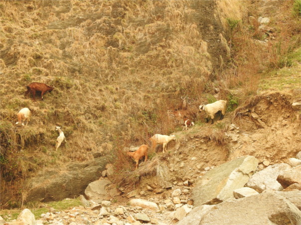
Going northwards from Almora to Munsiyari, we crossed at some point from the Siwaliks to the lower Himalayas. We halted at the Birthi waterfall for a cup of tea. Thick smoke enveloped the area, and I was glad to have my N95 mask on. The sunlight that filtered through was a strange yellow. I clambered up a small slope next to the road to look at the 80 meters high waterfall. The Ramganga river fell from the upper plateau down before me, pooled briefly, and then flowed on to my left. Goats grazed on the cliff opposite me, their tinkling bells the loudest sound around me.
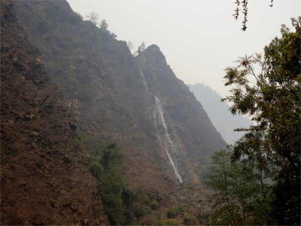
The Himalayas are still growing upwards as the Indian and Asian continental plates push towards each other at a speed of about 50 to 60 mm every year. The lower Himalayas are created by the buckling and twisting of the Indian plate, and the upper Himalyas by the Asian plate being pushed up as the Indian plate plunges north. East and west of the Kumaon region there have been many huge earthquakes in the last century and a half, but the Kumaon region seems to be miraculously stable. Still, that high wall of rock just across the stream from me seemed like the result of an ancient earthquake. Was it? A little search led to me to a paper which related it to the flow of the rocks in this region. What I’d seen here was continental movement, the driver of earthquakes and landforms. I’m amazed in retrospect.

