You don’t get to do the same walk twice. So, although this is a walk I’ve written about earlier, I’m doing it again now in monochrome, and the featured photo is one example of this reworking. I’d posted a colour photo earlier. Although I like that more, I’m not unhappy with this version. It kind of fits the slowly fading memories I have of the walk. And there is also a sort of shadow, a memory of a memory of a memory of an earlier walk along the same route in colder weather.
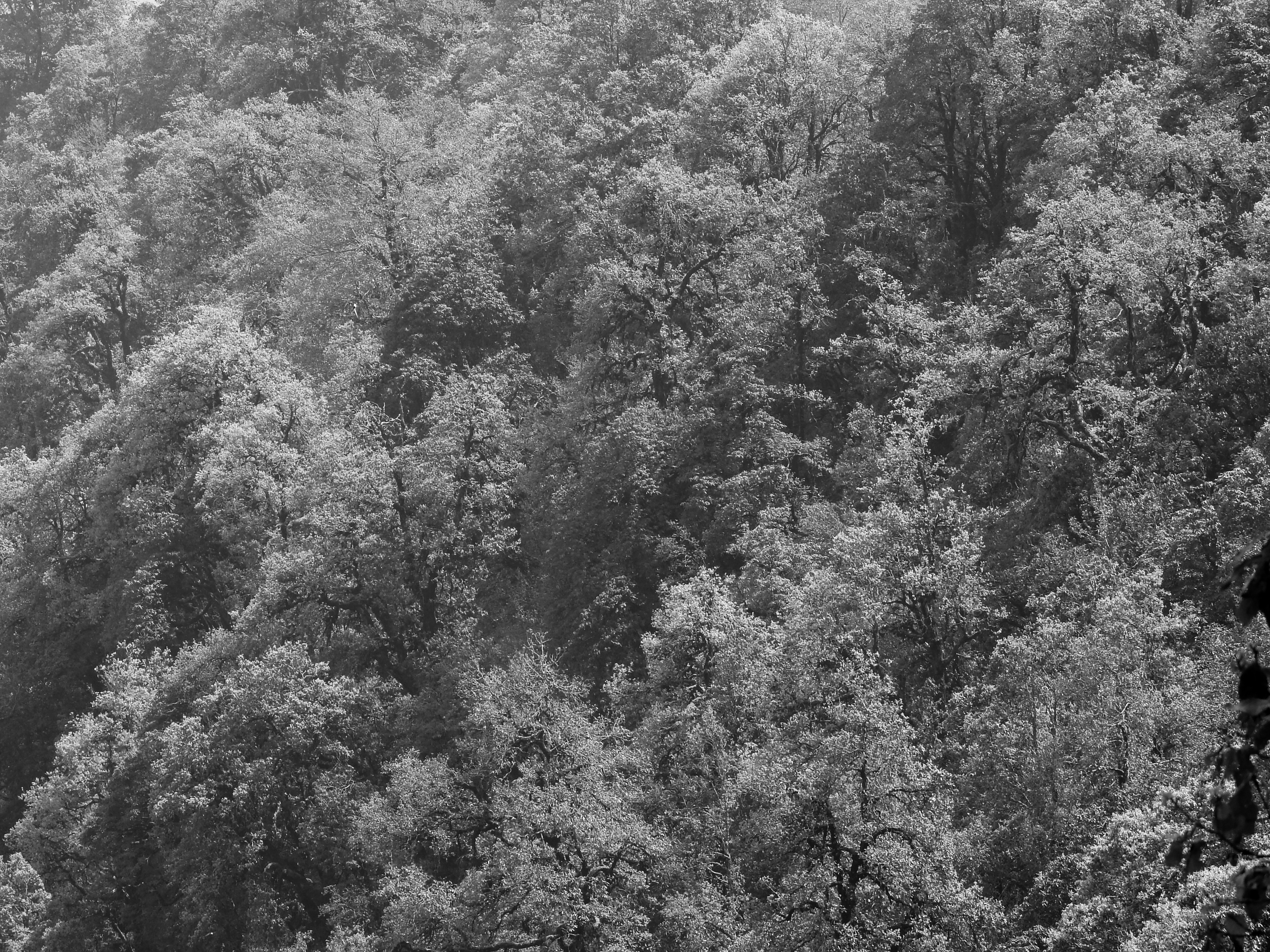
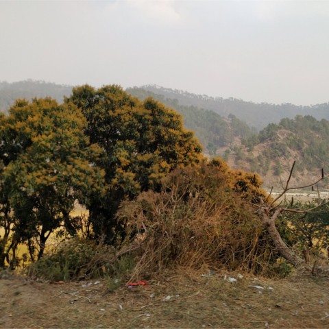
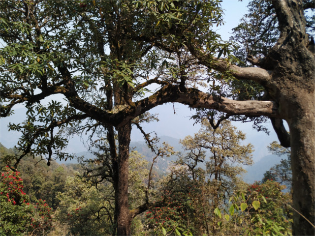
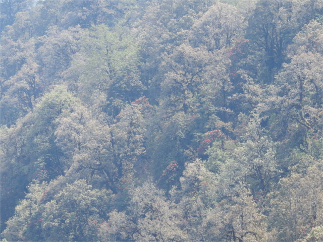
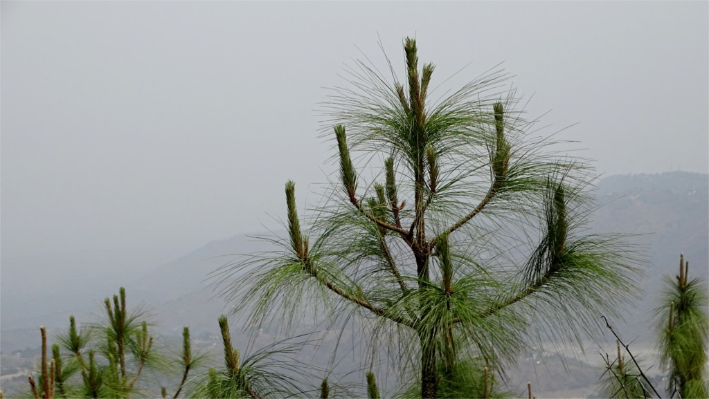
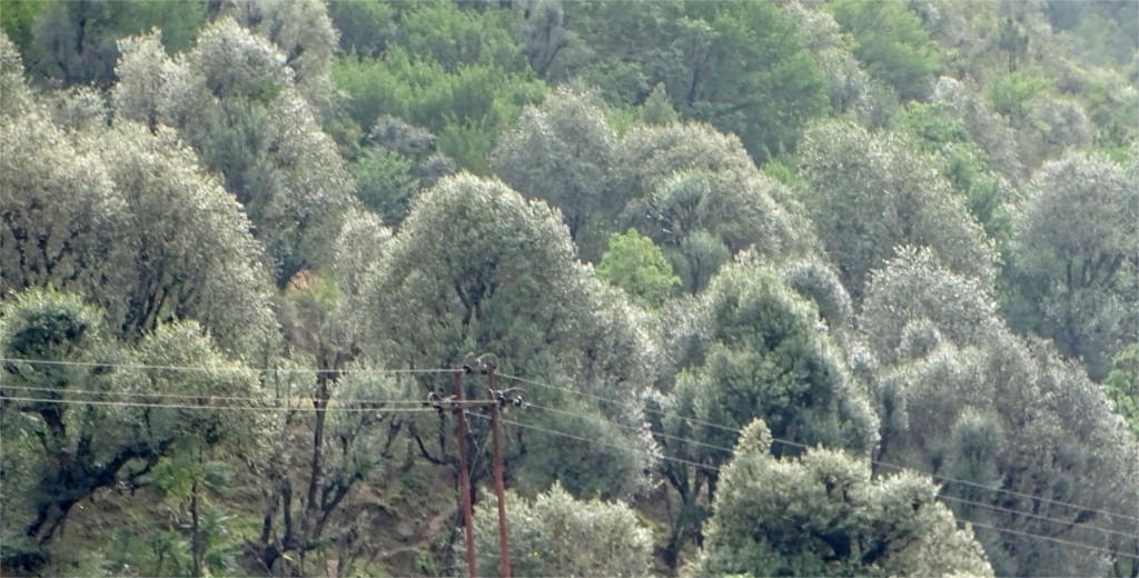
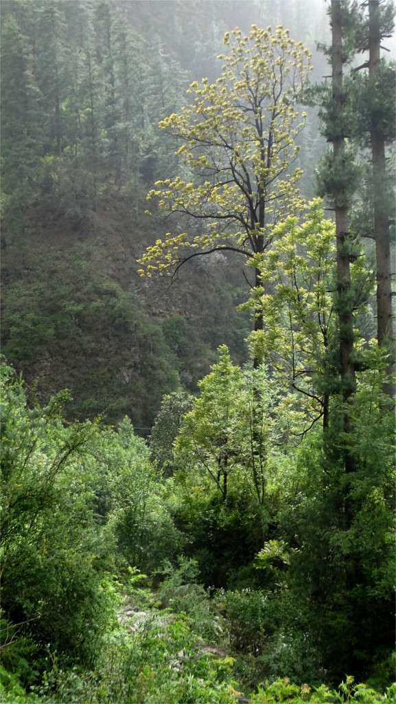
This part of Binsar National Park is a mixed oak-rhodo-pine forest, in a dynamic dance with pine grasslands on other slopes. My understanding of their interactions has certainly improved since I last wrote about this walk. I should really go back now and correct my earlier post. Although these pine grasslands are much maligned by local ecology activists, there is increasing scientific evidence that the politics is based on early twentieth century understanding that may need to be revised. The mixed forests are not more bio-diverse, they are only more full of larger animals. Slopes full of pines are very photogenic. Experimenting with monochrome, I found that long shots of these mixed forests are also turn out well. The white undersides of the leaves of Himalayan white oak (Quercus leucotrichophora) reflect light very well when a breeze moves them.
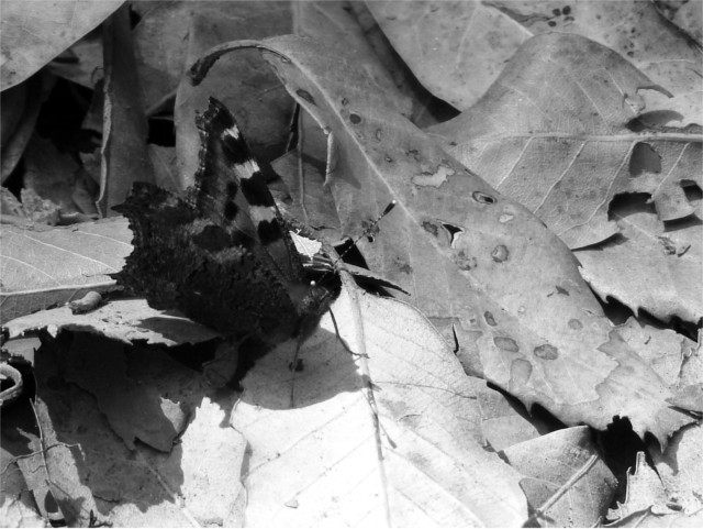
I’d stopped many times to take photos of the butterflies sunning themselves on the path. Fallen oak leaves spotted with mould in the dappled light which filtered through the canopy presented an interesting challenge in monochrome conversion. I like the way the butterfly appears slowly as you look at the photo above. This is the mountain tortoiseshell (Aglais urticae), which is easier to recognize in a colour photo I’d posted before.
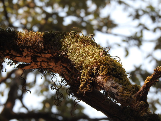
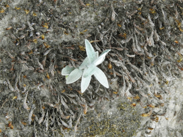
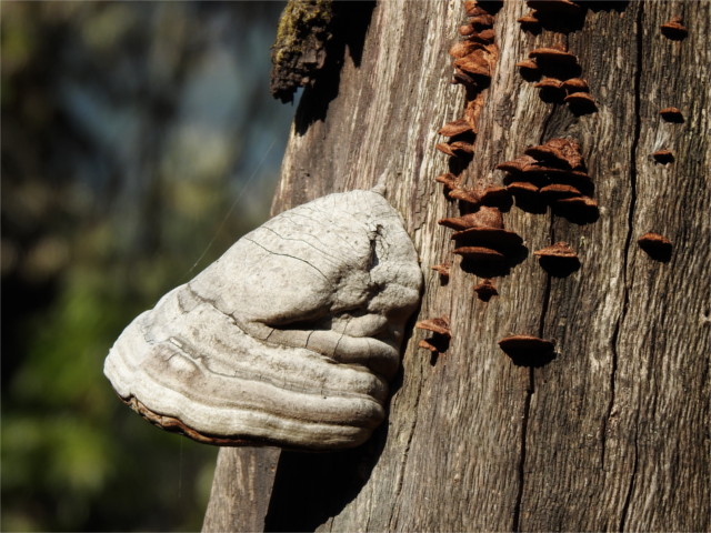
Oak trees support a lot of other plants and fungi which feed on them. These ferns, mistletoe, orchids, and lichens and fungi catch light in different ways. As a result, oaks are great subjects for close up photos. I love them in colour, but I’m not unhappy with the wide variety of shadows I see in the photo of above. I think I’ll have to keep that in mind for the future. I’m sure there are wonderful opportunities for more monochrome photos lurking in these forests.
I can’t leave this place without saying something about the mammals which live here. I never managed to photograph the quick yellow-throated martens which run through these jungles, but the band of Nepal gray langur (Semnopithecus schistaceus) which I saw here waited long enough for me to take photos. I’ve posted a colour photo of the individual you see here earlier. I think she looks equally elegant in monochrome.
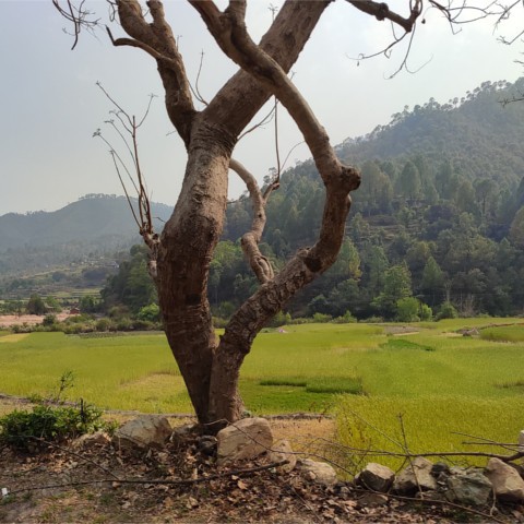
Our retreat from Kausani marked an end to the main part of our trip. The smoke from forest fires drove us down to the lakes. They are a beautiful part of Kumaon, but they are not the Himalayas. We were all sad to leave. We passed briefly through a mixed pine oak forestland. This patchwork of dense groves of white oak (Quercus leucotrichophora) and open grasslands stabilized by long-leaf chir pine (Pinus roxburghii) is the most ecodiverse part of this region. Under other circumstances, we could have had wonderful walks in such terrain, looking at birds and insects. The white flowers of kainth (Pyrus pashia, wild Himalayan pear) dotted the slopes. We drove past these forests quickly.
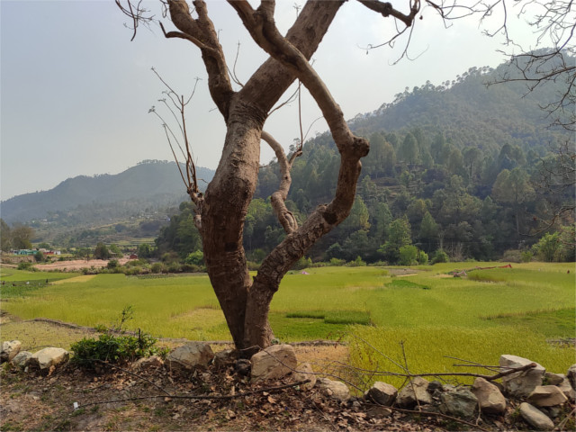
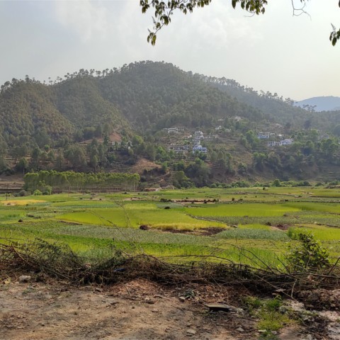
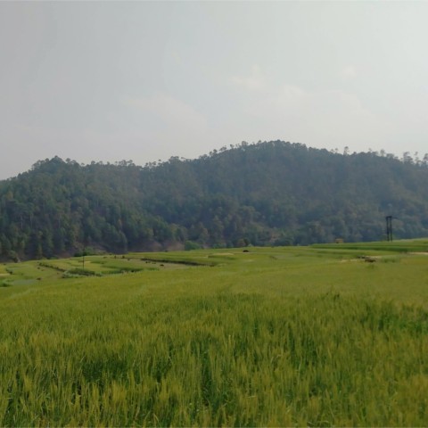
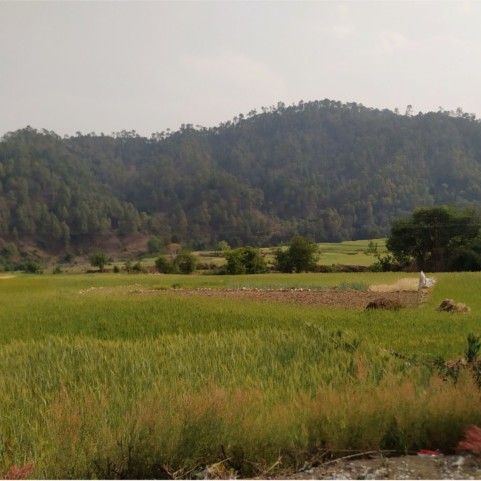
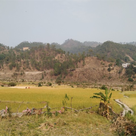
After this there is a part of Kumaon which gets little attention from visitors. It is a lush farmland. If you look at satellite photos, you see a patch of green slopes between hills which mark this region. But these high eyes do not show you what a pleasant land it is. The winter crop was a garden of green through the broad valleys.
Even here we could see fires in the pines on many of the slopes. Columns of smoke rose in the distance, and the air was saturated with it. Ironic that this trip, which we had thought of as a way of getting out into the clean air of the Himalayas, had exposed us to more smoke than we would have breathed at home. The N95 masks saved us during the day, but the strange light in our photos still remind me of the air that we passed through. The wheat had already begun to ripen in some of the fields. The lush green was dotted with gold. Trees were deliberately planted along berms.
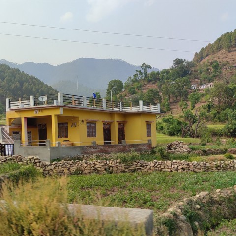
Most houses were on slopes, with the fields down on the valley. But there were a few houses right by the road. They were typical plains houses: single story, a flat concrete slab for the roof, held up by concrete columns, steps leading up to the terrace on the roof. Many houses had a vegetable garden near it. We drove by too fast to see what vegetables they grew. We passed banana trees, and mango, exotic to Kumaon. There was no sign of buransh or kainth. This was not the Kumaon of Corbett.
In a couple of hours the road quickly climbed out of the valley. We were approaching Raniket. It was time for tea.
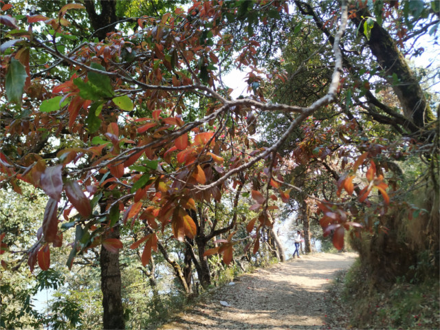
The breeze blew cool and clear. There was no one close by on the path up to Zero Point inside Binsar National Park, so I pulled my mask down to smell the trees around me. Oak forests don’t have the pleasant resinous smell of pines, but they are so much more alive. At this height, about 2400 meters, the Himalayan white oak (banj, or Quercus leucotrichophora) should be close to its upper limit, but they looked like they were thriving away from the hard competition with chir pines (Pinus Roxburghii) on lower slopes.
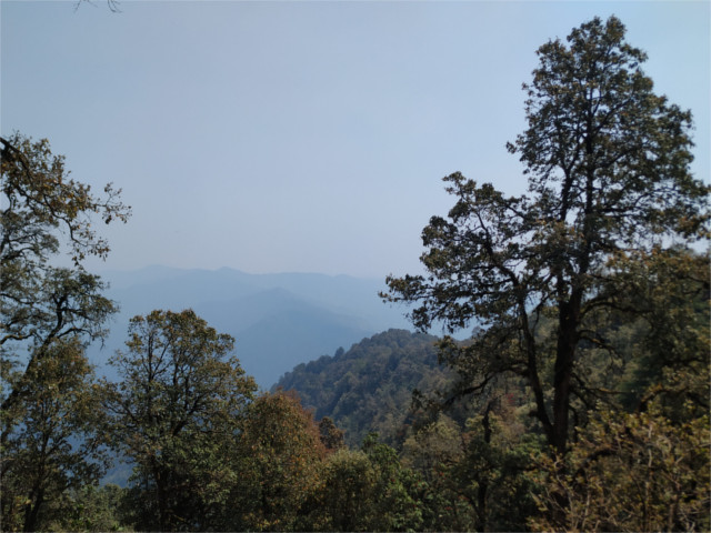
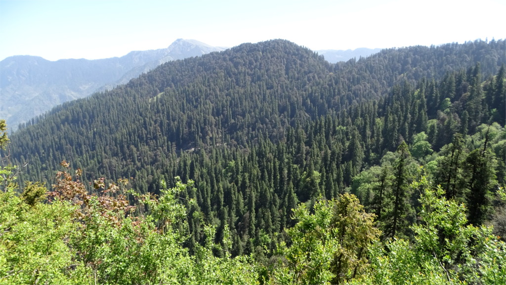
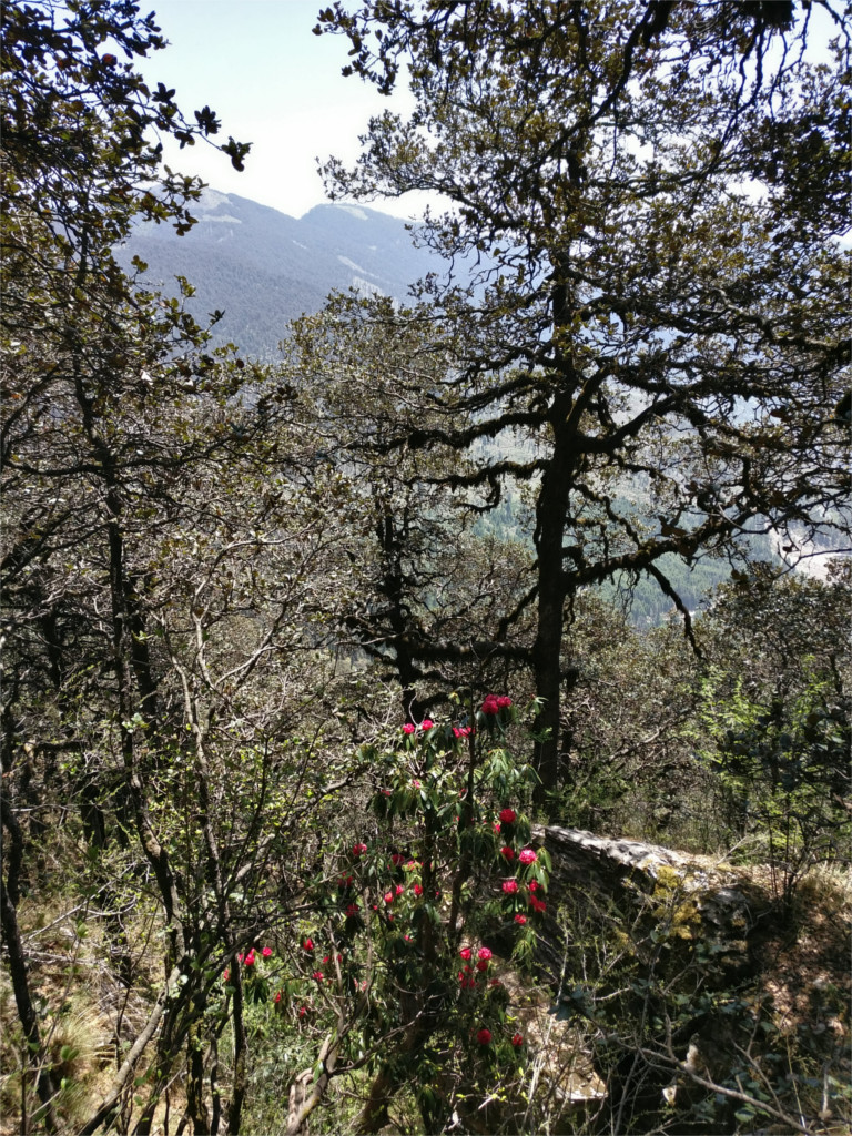
Oak forests are alive. Langurs prefer banj oaks as roosts. A yellow throated marten streaked across our path, it is another inhabitant of banj forests. I could hear a woodpecker looking for lunch, and, from a distance, the call of the Great Barbet. This forest was full of birds: seed eaters, acorn gatherers, and insectivores. The oaks themselves harbour life: fungi, lichens, ferns, orchids, and mistletoe. Butterflies flitted about on the sun dappled path. On gentler slopes the canopies merge together to provide complete shade under them, making it hard for younger trees to grow. But up here, the slope was steep enough that there was always a gap in the canopy, and rhododendron and other trees could spring up. Still, the forests of the western Himalayas do not seem to have the exuberance of the east. The monsoon winds create this difference.
The smaller number of large trees here gives me a chance to slowly begin to recognize most of them. A few years ago I made myself a small and incomplete field guide to trees of the middle heights. I’ve added to that by now, and I realize I can recognize most of the trees around me as I walk. But the herbs are another matter. I stop and look at the small plants poking out of the muddy cliff on one side of the path. I haven’t the faintest clue about them.
I could stick to the trees for now. The path is surrounded by oaks. I’ve aways been a little surprised by that. Oaks, mistletoe, holly all sounded exotic to me when I grew up surrounded by mango, guava, jamun, and silk cotton trees. But to my surprise the genus Quercus, oaks, seems to have its origins in a part of an ancient continent which is today East Asia, in the middle of the Eocene Epoch, perhaps about 45 million years ago. That was just after the earth had gone through one of its temperature maxima (there were no ice sheets anywhere on the planet) and the Indian plate had just banged into Asia. Over the geological ages after that, the oaks adapted to the cooling climate, and crossed the Himalayas into Europe. The five Himalayan species found themselves settled at various heights, Q. leucotrichophora at the lowest altitude. During the multiple ice ages of the Pleistocene Epoch the white oaks seem to have covered a very large part of the lower slopes.
Most observers agree that the oaks are slowly being crowded out by pines on the lower slopes. I asked why, and got different replies. The literature is also a little confused, but I tried to make sense out of what I read and heard and got an interesting story. The two main threads in the plot are how fast the trees grow and how they respond to fire. Once the acorns germinate, the oak seedlings can halt growth until conditions are just right. This requires a moderate disturbance of the forest to let in some light. In the days of Jim Corbett, this was provided, at least partially, by human intervention, as villagers chopped off a few branches of older trees for kindling, and removed some of the leaves for fodder. But now this activity is forbidden, for reasons that were well-intentioned. As a result seedlings lie in arrested growth for long times in unattended forests. The trouble is that in recent decades a “fire season” has become part of the annual cycle in the ecology, probably due to direct human intervention. I have read no account of it in the older literature on Kumaon. Fire affects the slow-growing oak seedlings disproportionately.
Pines, on the other hand, are adapted to grow in degraded land, and can reach a height of 20 meters or so in a decade. Fire also causes pine cones to open up and release spores. As a result, chir pines out-compete and out-grow oaks. They are also more immediately useful for commerce, so the forest department manuals on planting and harvesting of pines are widely used. Oaks provide more ecosystem services, but they are not seen as commercially viable products. As a direct result, I could not find any manual on oak silviculture. When I reached the end of the walk I could look down at the surrounding slopes. The nearer ones, inside the park, still held many stretches of oak forests. Further off, there seemed to be more pines.
[Note added later: much of my understanding behind this paragraph may have to be revised in the light of new scientific findings about pines and their stabilizing role in the previously unrecognized biome called Himalayan grasslands. Through the 20th century they were thought to be degraded forests, but are now recognized as a separate biome with support for a different set of species. The dynamic balance between oak forests and these grasslands is still being studied.]
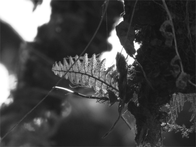
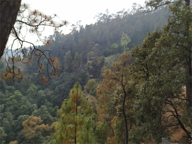
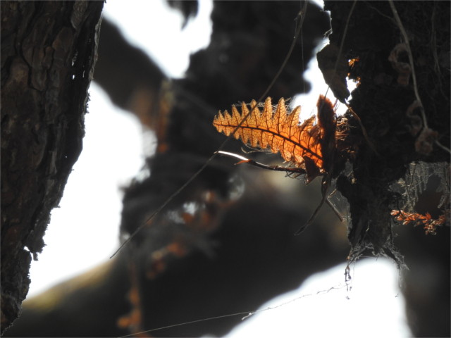
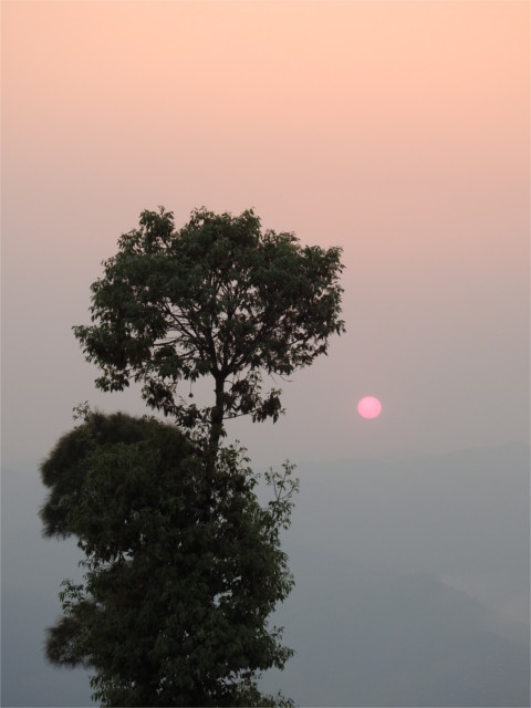
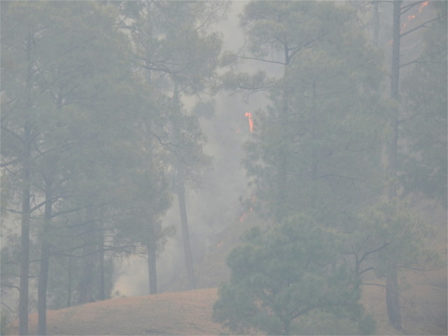
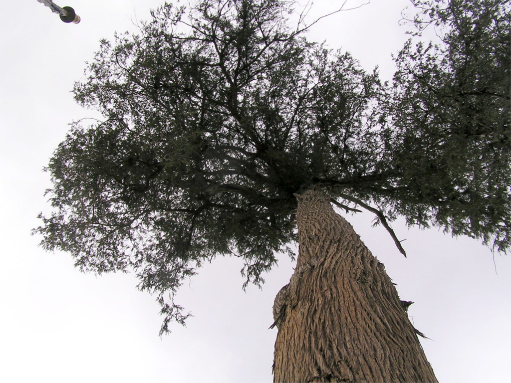
We took an hour’s walk inside Binsar National Park, a short climb to its highest point. This Zero Point, as it is called is at an altitude of just over 2400 meters. The cool air at this height smelt clean, with a flavour of green trees. The view at the top showed smoky valleys, and the high Himalayas were almost invisible because of the haze. But just around this part of the park the winds and the cool heights had together managed to confine the smoke below. I’m sure that the air here is usually much cleaner, but at that time it still felt better than city air. The walk through an oak forest was wonderful, and a great change from sitting inside a car all day. At this height you get Himalayan white oak (Quercus leucotrichophora), easily identified by the fact that the oval leaves with serrated edges are white on the reverse. The dry tree fern that you see in the featured photo is just one of many things which grow on oaks.
Coming back to our hotel, we felt the change in the air. Warmer, of course, now that we were half a kilometer lower, and also more haze. Fortunately there was no smell of smoke in the immediate vicinity. We were told that a short shower the previous day had put out fires locally, and cleared the haze a little. I admired a red sunset as I walked up the steep forested path from the road to the hotel. Pollution gives you interesting sunsets.
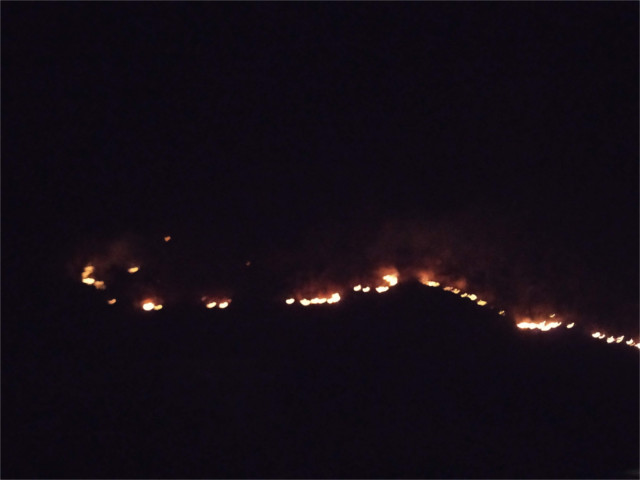
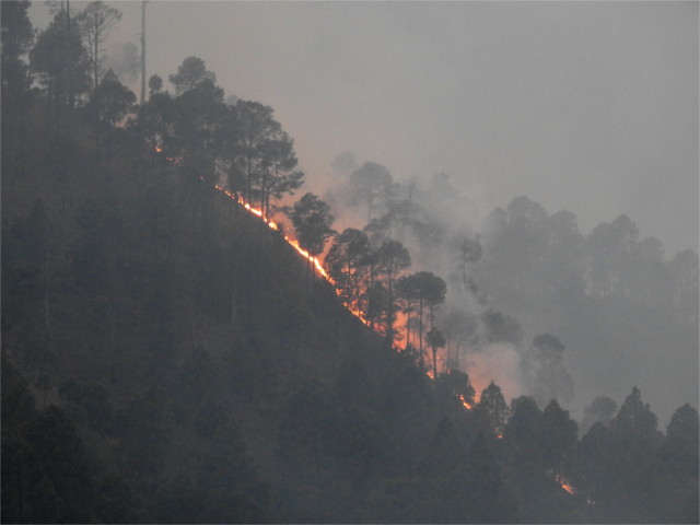
April 2: We reached Dehra Dun’s airport (altitude 558 m) in the morning, two hours before our flight. It was crowded, no social distancing, and we were glad for our double masks. Two hours stretched to four and then a brief announcement of the cancellation of our flight. The gate agent said “Bad visibility”. Huh! The sky was absolutely clear. Tickets were refunded quickly, and the baggage handed back. Our one hour flight by an ATR-72 was to be followed by a four hour drive to Almora (altitude 1604 m). This now became a ten hour drive. What causes less pollution: fifty people on a single flight, or them individually, or in groups, driving the same distance? Late at night, climbing past Naini Tal (altitude 2084 m), I spotted fires on the forested slopes. The smell of smoke penetrated my mask. Bad visibility began to make sense.
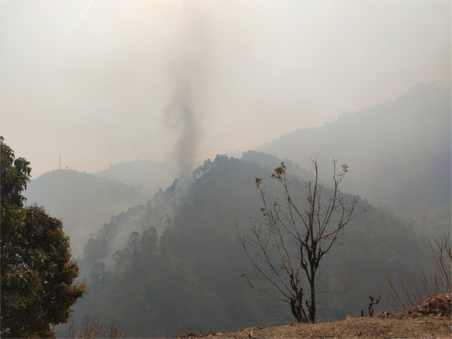
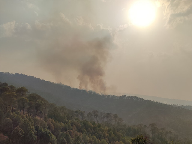
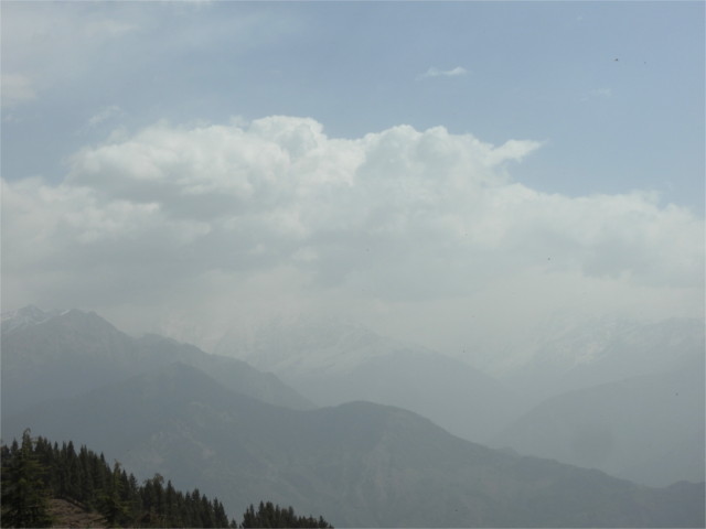
April 3: Forest fires do not always give you spectacular photos, sometimes all you see is haze. The next morning as we walked through the forest trails in Binsar National Park (altitude 2410 m), the haze in the air cut off all views of Nanda Devi (altitude 7816 m), Trishul (altitude 7120 m), Panchachauli (altitude 6904 m). That was part of the reason for coming here. Most of the haze seemed to be lower down, and I couldn’t smell any smoke. We took the short walk up to zero point, the highest place in the park. I looked up the SPM levels in Almora, which is the nearest place where measurements are taken. That seemed to be at a level where exercise could be unhealthy. Much of the next seven days we would find ourselves surrounded by haze, the smell of smoke permeating our masks. The air quality was dangerous very often, preventing us from taking the walks we had planned on.
April 4: We’d planned a long drive from Binsar to Munsiyari (altitude 2200 m). It was not only tiring, after the unplanned drive two days before, but also took us through hellish terrain. At times the fire had spread to areas right next to the road. May and June are often a season of forest fires through Kumaon, but this winter had been warm and dry. Forest fires had apparently started in October 2020. People we talked to expected that it would continue till the monsoon. In cities, since the air is always bad, most people have become conscious of the effect of haze and pollution on health. In this place, where the air is normally clear, that understanding has not taken hold.
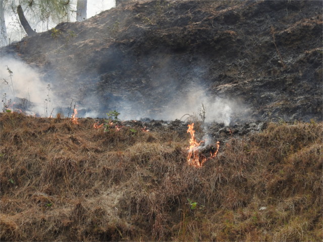
Why do fires start? We got multiple answers to this question from people we talked to, and perhaps all of them are right. One said that some fires are set by villagers, and they go out of control. Usually winters are wet, with rains every couple of days, and the fires are easily doused. But this was a particularly dry winter. It hadn’t rained for a week in Binsar, we were told. Perhaps. Rains were predicted when we packed, so I’d brought along a light poncho which was never unpacked. A dry winter leads to conditions where fires can go out of control, and then large scale fires change conditions so that it does not rain. This out of control feedback seemed to have set in over Kumaon.
Others told us about the forest department setting fires to clear deadwood. In Almora someone showed us the thick carpet of dry leaves which had fallen off white oak trees (Quercus leucotrichophora, banj in Hindi). This was the reason why fires run out of control, he said. Someone else showed us thick mats of needles dropped by Roxburgh pines (Pinus roxburghii, chir or cheel in Hindi) as we walked through Binsar. This was the reason why fires were raging he argued. Both were right, of course, a dry winter produces kindling. One person told us that green branches of oaks burn readily, which is why villagers use them in the kitchen when nothing else is available. But the fires around us carried a smell of pine resin. When I stopped to take the photo above I could hear the popping and crackling of pines as they caught fire. Oaks could burn, but many of the slopes have extensive pine forests.
The air did not clear up as the road climbed to Munsiyari. The place is known for its views of Panchachauli, but through this thick haze we would have to be very lucky to see anything. The road climbs to about 2500 meters before dipping in to Munsiyari. At the very top of the climb we were lucky enough to spot a female Koklass pheasant (Pucrasia macrolopha) as it ran across the road. We stopped the car and tiptoed to the edge, and I saw the male in the split second before it noticed me and disappeared into the undergrowth. Both were lifers for me. Between the bad light and the fast movements a photo was impossible. When we reached our hotel and looked at the TV news, it was grim. The fires had spread from Kumaon into Garhwal. A significant fraction of Uttarkhand state’s 53,000 square Kms was on fire.
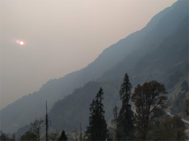
April 5: We’d selected the hotel for the view of the mountains we would have. But the thick smoke covered everything. When something like this gets into the news, you can bid goodbye to reason. There was a lot of finger-pointing and buck-passing in and off prime time. Why would the forest department not be more careful? Someone said that they hire contractors and they do not follow guidelines. What was the state government doing? They borrowed two helicopters from the air force to dump water on the fire: one for Garhwal, another for Kumaon. Such a large part of the state was on fire that this inadequate move had to be nothing but optics for TV. Meanwhile, on the ground there was no major change. By evening we’d got a few drops of rain. Perhaps the next morning would be good. We were to leave for Kausani (altitude 1890 m) late in the morning, and we might get a view of the Panchachauli before we left.
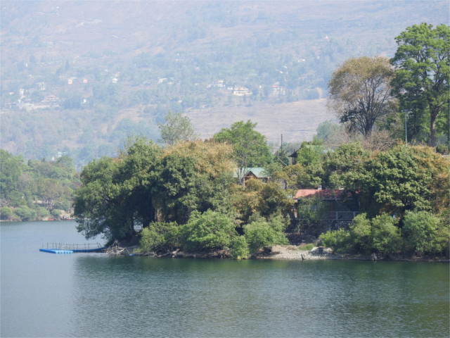
April 6: It rained for an hour at night, and we woke up to a faint view of the mountains. There was also time for an hour’s walk up before we left for Kausani. The hills around Kausani were ablaze, and the smoke was terrible. We decided to cut short our stay here and retreat to the lower lakes. They had had crystal clear air when we came up. We had a long chat with the owner of our hotel over dinner. He thought that the connection between ordinary people and the forest had been cut because the forest department stood between them. It is an interesting point of view, and I’ve heard variants of it before: conservation can only come when the state becomes a helper to the people who live in a landscape. If you give people no stake in the land or forest, they will not take care of it. True enough, I suppose, but was this the whole story of this disaster? Such a large scale disaster must have multiple causes.
April 7: It was a short drive to Naukuchia Tal (altitude 1220 m), so we had time to chat with people on the way. One theory we heard was that trees are money, and fires are a good cover for illegal trade in trees. Stories of corruption have a way of circulating, and you don’t know whether they are correct unless someone takes the trouble to investigate. With all these varied viewpoints about human motivation, one thread was constant: that this was a dry year, little rain, and the fire was spreading because of that. This part of the story was something we had experienced. The drive took us through several patches of burning forests. Were there more fires where there were more people? I could not tell.
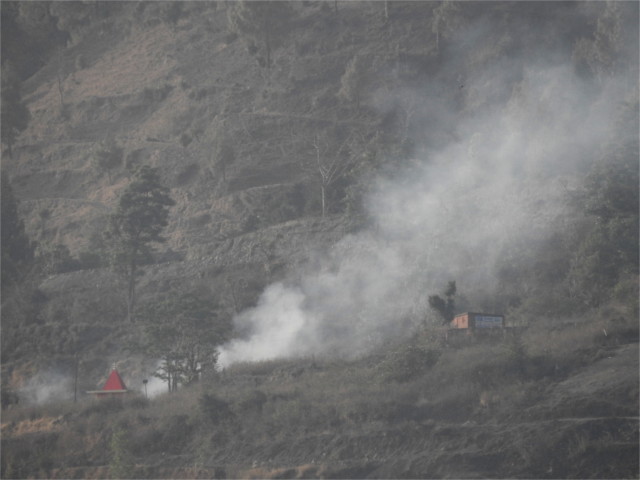
April 8: The air in Naukuchia Tal was relatively clear on our first day there. We even saw worker clearing away dry leaves from the slopes around Naini Tal, perhaps a precautionary measure. In the evening we saw a big plume of smoke on a slope across the lake. It died out within an hour. It seemed to me that someone in a farm had set fire to the stubble left over in the fields after a harvest. Luckily this didn’t spread. How widespread was this risky behaviour? I recalled reading that when farmers had two crops a year they would leave the stubble in the fields to rot back into the earth. As they move to three crops a year, they want to clear the stubble faster, and use fire to do it. I’d seen government advertisements on the long drive from Dehra Dun requesting farmers to stop this practice. Was there an alternative? I haven’t followed this issue enough to know the answer.
April 9: The morning was not as clear as it had been the previous day. Clearly the fire had come closer during the night. We decided to drive to Mukteshwar (altitude 2170 m) for lunch. There are supposed to be good views of the high Himalayas from this little town, but we neither expected, nor got, any view of the mountains. The smoke obscured everything. We dropped in to the Devasthal astronomical observatory (altitude 2450 m). The 4 meter liquid telescope was under maintenance. Viewing was said to have been wonderful from here in the 1960s and 70s, but in recent years the moisture content in the atmosphere has increased, obscuring the telescope’s view somewhat. Another victim of climate change! Astronomers have moved to Leh in Ladakh, and the world’s largest telescope could come up there soon.
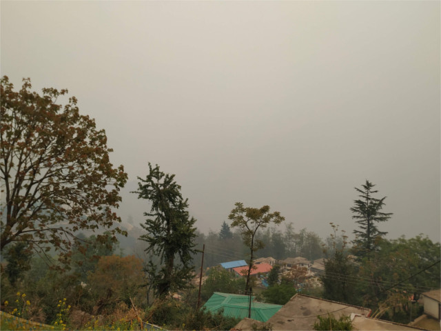
April 10: Our bags were packed for the last time. We would spend the day at Sat Tal (altitude 1730 m) and drive on to the plains. The Sat Tal valley smelt of smoke. We’d only had one clear day till now, our first day in the lake district. The evening news spoke about these forest fires spreading into the Nanda Devi National Park. Ecological disasters seldom make it to the TV news channels or the large circulation newspapers. Even now, even with forest fires on this scale, this news was being squeezed out by the rising COVID-19 second wave and the state elections across the country. The next day, as we drove to Delhi (altitude 220 m) to catch our flight back home we read that the air force helicopter which was requisitioned for fire fighting in Kumaon had been sent back without being used at all.
What did we learn? The weather is definitely a major factor; in dry years like this the risks are immense. Most predictions agree that a warming climate is also a wet climate, but there will be local differences which are not yet worked out. Along with the climate, there are multiple human factors involved in safeguarding the environment within which we have to live and work. Why do farmers set fire to their fields every year? Farming is under stress, and farmers should have a stake in clearing fields safely. In Uttarakhand, where farms and forests mingle, mistakes are costly. Similarly, the methods of clearing forest debris may need to be re-examined. Do common people have a stake in the health of the forests? The government’s stewardship of the land has to involve the local population, otherwise there are just not enough hands to fight fires. These are all big questions, and many people are thinking about it. We just happened to be caught in the middle of an object lesson for a few days.
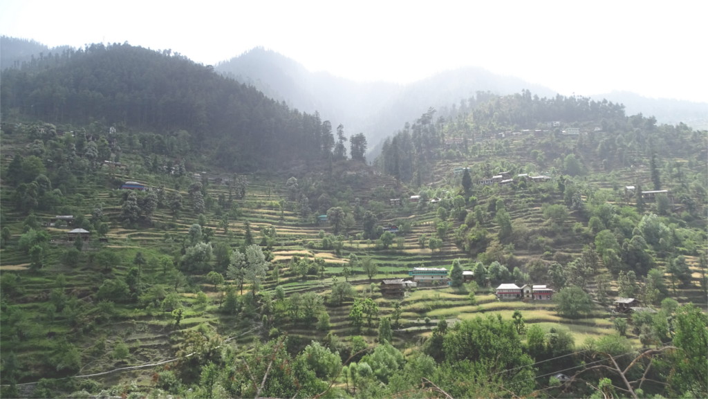
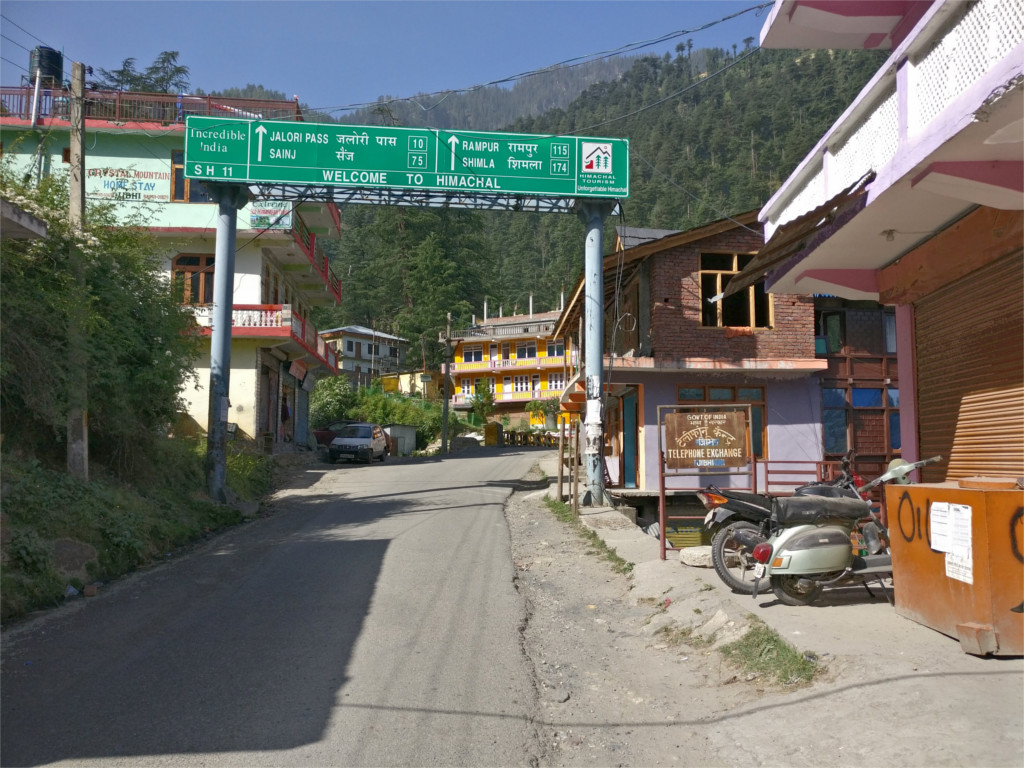
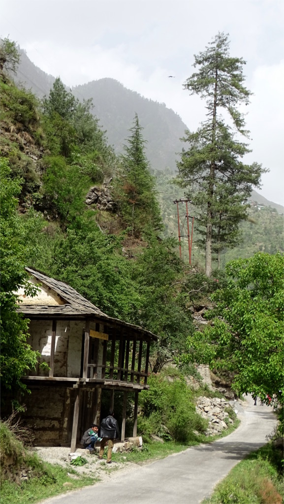
The distance between Jalori pass and Gushaini is not large, but the roads are narrow and hug the mountains above the winding courses of the Tirthan and Banjar rivers. We drove quickly through the town of Banjar. We had a glimpse of shops fronting narrow roads. A few turns, and the road had left the town behind. We wanted to stop for chai, and Soni decided that Shoja is the best place for a morning’s cuppa.
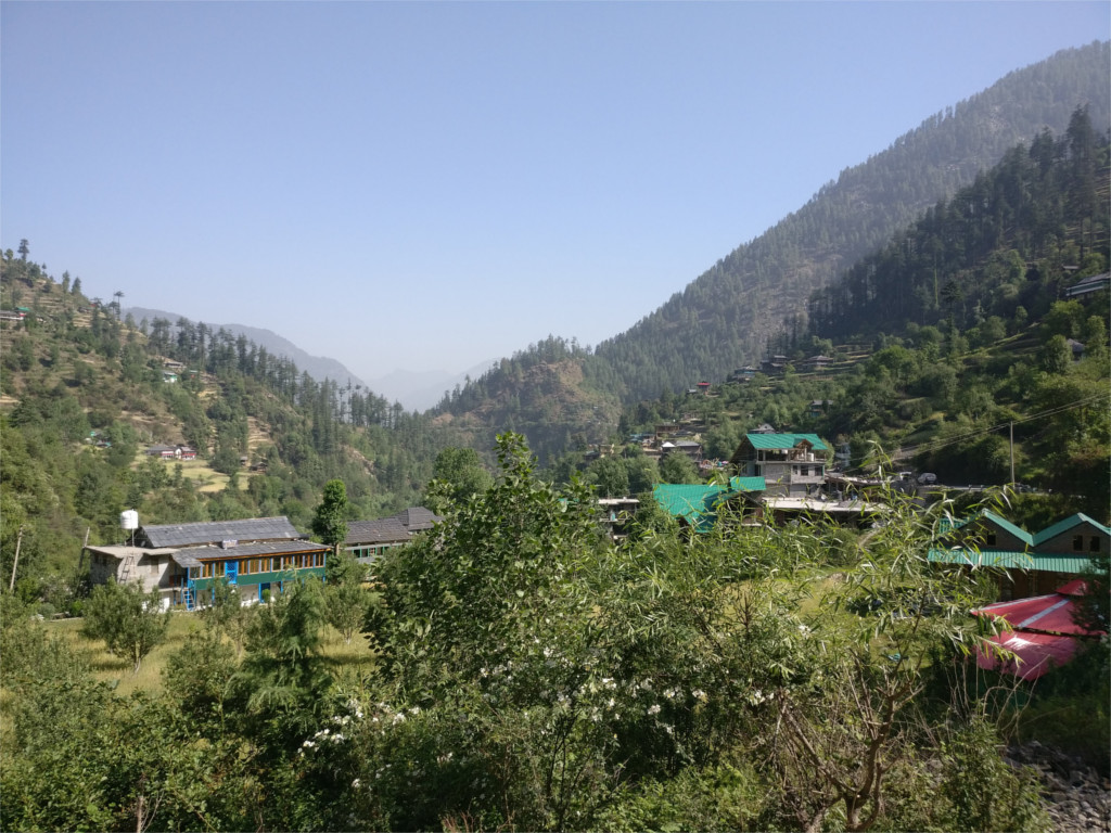
Shoja turned out to have all the charm that Gushaini and Banjar don’t. The Young Niece oohed and aahed about the view, so I walked with her a hundred meters along the road to the end of the town and took the featured photo. We’d been seeing these terraced fields near every village, but this was the nicest view of that we’d had. The clumps of chir pine (Pinus roxburghi) and banj oak (Quercus leucotrichophora) salted through the fields, clouds descending from the mountain tops, and the beautiful light were something to enjoy in silence.
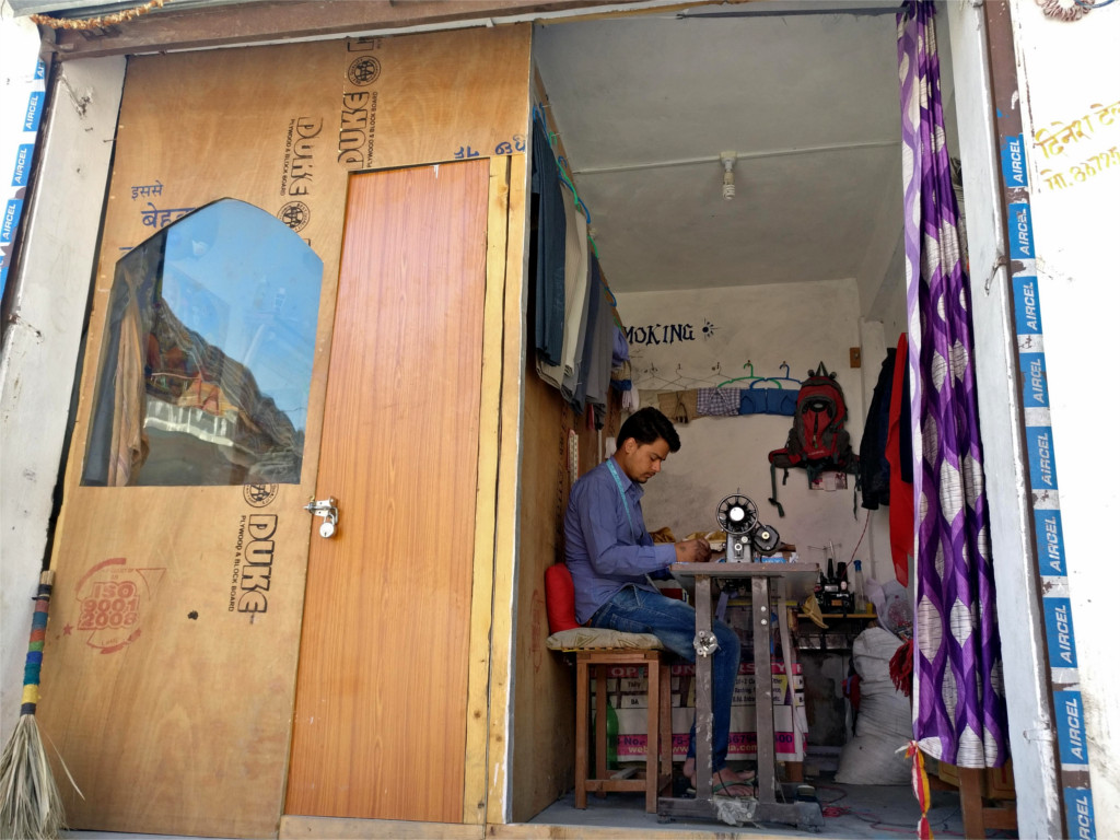
When we walked back our chai was ready. I gulped down my glassful and wandered up the road to take a few photos of the town. The tailor was already at work at his pedal operated sewing machine. The booth behind him must be the trial room. I was surprised that the village is large enough to support a tailor full time. I guess its main earnings are from farms and orchards. Tourism may bring in a little money, since there are possibly some home-stays and a hotel in this village. It looked very clean and more prosperous than Gushaini, but that may just be because it hasn’t grown haphazardly.
By now everyone had finished their tea, and we all walked back down the road to take another look at the farms around the village. I got another shot of the slopes and the farmhouses nestled in the fields. There are several interesting small walks around this village, but I had one planned at a higher altitude. We piled back into the car and drove on to Jalori pass.
There was little time to prepare for our trip to the Himalayas. I worried about whether I should pack Pradip Krishen’s field guide to the trees of Delhi, but then decided against it; after all most of this book dealt with trees of the plains. There are excellent guides to the birds of India, one for butterflies, ancient ones for other animal orders, and certainly nothing for the trees of the Himalayas. One of the few useful resources I came across was an excellent blog post on the trees of Shimla.
Chir pine (Pinus roxburghii)
White oak (Quercus leucotrichophora) and Rhododendron arboreum
Deodar (Cedrus deodara)
The quick field guide which I made for myself can be useful on future trips. There is such an incredible variety of trees across the Himalayas that anyone could spend a lifetime studying them. The little part which is captured in this small list served me as landmarks to orient myself by.
Name
altitude
characteristics
Deodar (Cedrus deodara) Himalayan cedar
1700-2750 meters across Himalayas
conifer, 40-50 meters tall, 10 meters girth, generally grows on northern slopes search
Rai (Picea smithiana) spruce
2250-2750 meters Western Himalayas
conifer, 40-55 meters tall, 3 meters girth, higher branches are upward pointing, really long needles, generally grows on northern slopes search
Rau (Abies pindrow) silver fir
2500-3700 meters Western Himalayas
40-60 meters tall, 7 meters girth, gray-brown furrowed bark, overall conical shape with level branches, needles have a white streak on the underside, dark purple erect cones, generally grows on northern slopes search
Chir (Pinus roxburghii) Himalayan pine
500-2000 meters across Himalayas
heavy cone, 40-50 meters tall, 6 meters girth, rough bark, needles are arranged in bundles of three, prefers southern slopes search
Kail (Pinus wallachiana) blue pine
1800-4300 meters across Himalayas
long cone, 30-50 meters tall, needles are arranged in bundles of five, bluish in colour, generally grows on northern slopes search
Banj (Quercus leucotrichophora) Himalayan white oak
1500-2400 meters Western and central Himalayas
15-25 meters tall, twisted gnarled trunk, rounded canopy, underside of leaves is white and hairy, acorns edible search
Moru (Quercus floribunda) (also Quercus dilatata) Himalayan green oak
1700-2700 meters Western Himalayas
25-30 meters tall, 6-9 meters girth, straight trunk with dark reddish brown bark, leaves 4-6 cms long and green on both sides search
Kharsu (Quercus semiscarpifolia) Himalayan brown oak
2800-3250 meters Western Himalayas
25-30 meters tall, 4.5 meters girth, straight trunk with domed crown, dark grey bark broken into small plates, 2.5-10 cm long leaves, with brown underside search
Phaliyant (Quercus glauca) ring-cupped oak also Japanese oak
widespread
15-20 meters tall, straight trunk with domed crown, dark brown furrowed bark, leaves purple red when new, powdery blue-green underside when older search
Bras diverse genus rhododendron
1500-3000 meters across Himalayas
shrubs and small trees, glossy leaves, sometimes with a scaly underside, bright flowers search
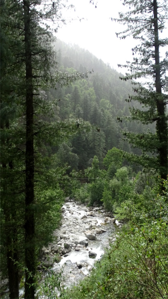
The Falachan river descends from the Zangsu glacier, falling rapidly from about 5 Kilometers above sea level to about 1.5 Kilometers, where it merges into the Tirthan river. We spent a quiet afternoon walking in the Falachan valley at an altitude of about 2 Kilometers. The Family is always magicked by heights. This was the first time The Young Niece had been in the Himalayas, and she was listening to The Lotus talk about the mountains. At one especially beautiful point in the road I took three photos: the featured photo and the two below.
A traditional wooden house with slate roof stood on the road, and below us the Falachan moved rapidly. We crossed a high bridge to a hill on the other side of the river. The untarred path from here moved down in a steep slope to nearly the level of the river. It was late afternoon. We’d eaten a large lunch, and one of Ram’s lovely desserts: chocolate balls dusted with coconut powder. The Young Niece protested about the coconut but ate twice as many as any of us. Now we were walking off the lethargy that usually follows such a lunch.
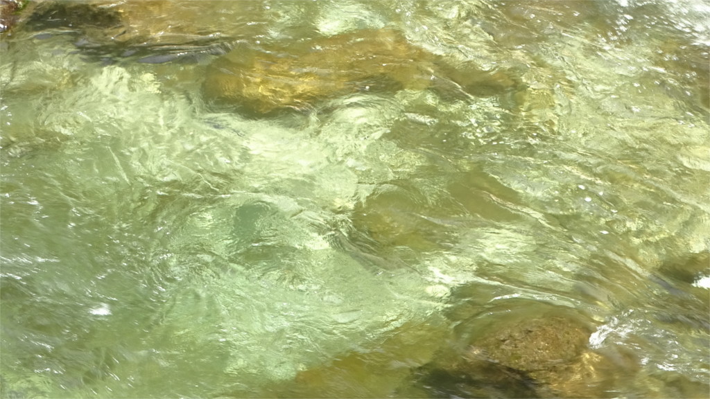
The glacier-melt of the Falachan was absolutely clear. In the golden sun I could see the bottom clearly. Since we were on a holiday I could take my time to gaze at the hypnotic sight of eddies over the stones at the bottom of the river. There is trout here, but I could not see them. The others walked on, leaving me to catch up. I was trying out long exposures on my camera, but I’d forgotten to bring a tripod on the trip. I would be able to capture a sense of the eddies, but not the silkiness of the water.
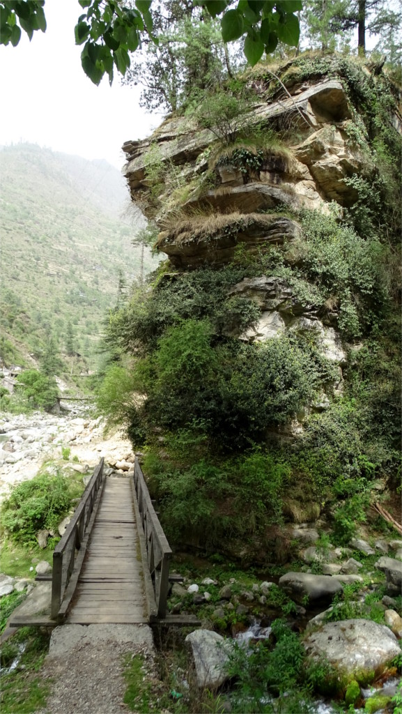
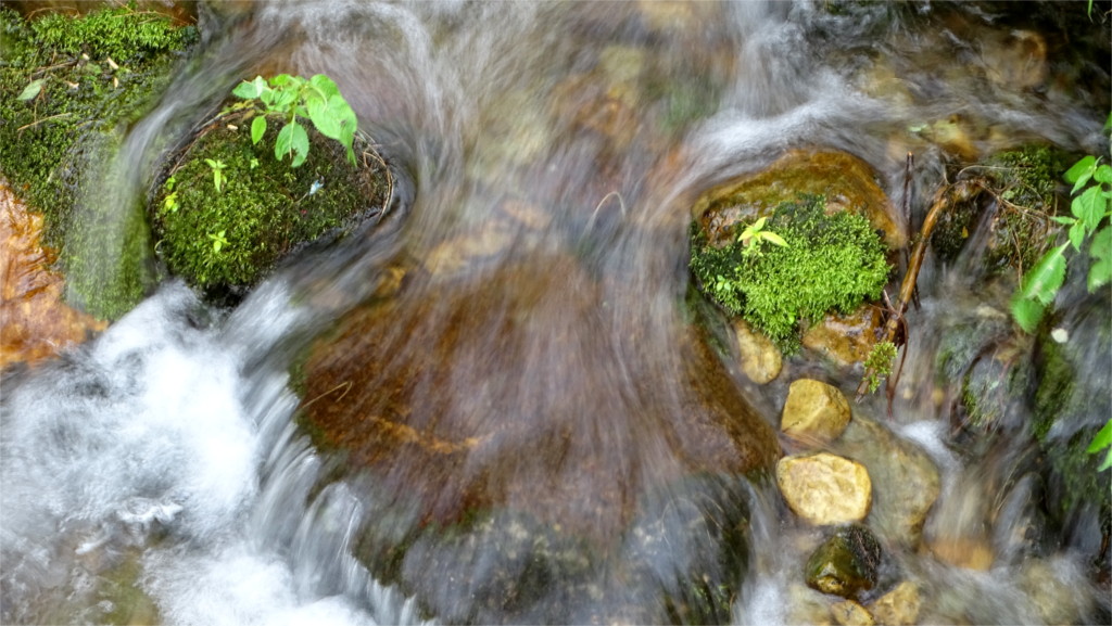
I followed the others, crossing a rickety little bridge over a rushing waterfall. It swayed as you walked, and some of the planks were better avoided. In one place a plank was missing and you had to skip over the gap. The stream was not far below. A fall could be nasty, but not fatal. We’d seen bridges like this before, but it was a novelty for The Young Niece. She was very excited and waiting for me on the other side. I stopped on the bridge to take a photo of the rushing water. Two outcrops channeled the water into a narrow stream, creating a very shallow rapid. A tripod would have come in handy here. With a really long exposure I could have got a sense of the silky smoothness of the film of water rushing over stone.
The photo that you see above is the longest exposure I could get standing on that swaying bridge. All this water eventually derives from glaciers. Nowadays I cannot help thinking of what climate change would do. The glaciers are melting faster than before, the shallow waters are still not too warm for trout. Not too far in the future, the last of the ice will melt, and the land will become dry. The evergreen forests will already have changed in composition, but as the hills die, the vegetation would no longer hold the soil, and it will start eroding faster. Life in the hills will certainly change. But the afternoon was too pretty to waste on morbid thoughts of a world only The Young Niece would see.
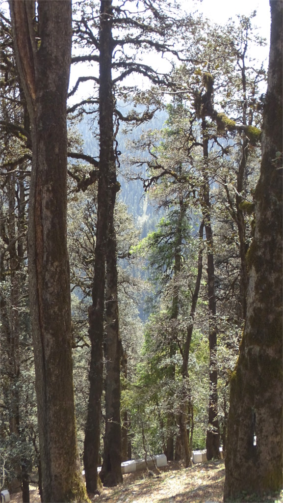
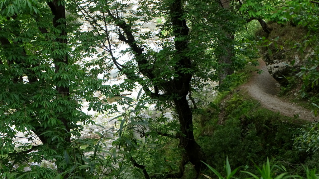
We decided to follow the path up. Was there a destination? We weren’t sure. There were some villages along the path, but we had no idea how far off. This whole area was full of flowing streams and mountain springs, so a high village would not have a major problem with water. Of course, villages tend to grow, and eventually to use up all the water available to them. We had decided to avoid coming through Shimla because it was completely without water. From the road we’d seen a forest of chir pines (Pinus roxburghii). They are the most abundant trees at these lower slopes of the Himalayas, and very little can grow below their canopy. However, chir pine needs sunlight. On this north-facing slope banj oaks (Quercus leucotrichophora, Himalayan white oak) arched over the path.
The Lotus is worse than me at slopes. He decided to rest under the oaks. The Family wanted to walk up a little further. I followed, and The Young Niece, who was still energized by the dessert, came along. There was a steep bit right at the beginning, but then the path levelled off after a turn around the hill. This southern slope was full of chir pines. In the massive trunk of one I saw that rusty iron trishuls had been planted, and they were festooned with the gauzy red scarves reserved for holy sites. Trishuls hold an ambiguous place; they are weapons, but they are also religious objects. I pointed out the rough bark of the chir pine to The Young Niece. The ground was strewn with the pine cones and needles. When the layer of needles is thick enough it deters other trees from growing through.
There was no sign of a village. I hadn’t really expected one closer than five Kilometers away. We could look down into a narrow gorge cut by the stream which later becomes the waterfall crossed by the rickety old bridge. There was a single house by the stream, at the bottom of a cascade of rhododendron trees. Unfortunately the flowering season was over. Looking up-slope we could see another single house at the top of a scarp. This single family had terraced the slope in front of their house and converted it to agricultural use. I thought of all that this must have involved. I don’t think that I will be able to do that kind of physical labour. We turned back from this point.