Turtuk: lives and livelihood

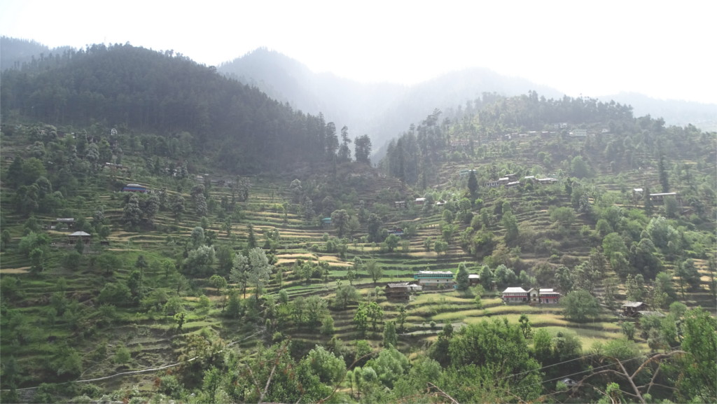
We hear the word village and we think of fields and farming. We’re never wrong about this today, although the first villages are found from about 3000 years before agriculture developed. Over millennia, the development of agriculture has completely wiped out the hunter-gatherer economy that birthed villages. Turtuk was surrounded with terraced fields, largely given over to wheat, but with patches full of a variety of vegetables.

Between houses there were numerous apricot and cherry trees. Both of these fruits were different from the variety we’d eaten before. The apricots were small, perhaps 2 or 3 centimeters across, and terribly sweet. The cherries were also tiny, about 5 millimeters across, and tasted tartly sweet. We’d been seeing the dwarf apricots ever since we arrived in Ladakh, but the cherries were new to us. Hunder, the village with our hotel, was at an altitude of 3000 meters. From there we’d driven downstream of Shyok for about three hours, and then climbed about 200 meters to Turtuk. That put us at an altitude which was about the same as Hunder. At these heights perhaps these dwarf varieties of fruits grow best.

The wheat was ripening in the fields. Lower down I’d seen the harvest in progress. But here it looked liked the growing season would last another 10 days or a week. Every isolated small patch of ground was used to grow something: vegetables. This was early enough in the season that I saw many vegetable flowers: potatoes (the featured photo), tomatoes (the Solanum flower in the gallery above), a cucumber with its edible yellow flowers, peas (perhaps, I don’t know its flowers), and others that you don’t see here, like carrots, radish, runners of beans and edible leaves, and the third edible Solanum, namely brinjal. In trips to jungles I equate Solanum with poisonous weeds. Seeing these three varieties of Solanum flowers in tended fields reminded me of the European reluctance to eat tomatoes and potatoes when they were first imported from the Americas. Quite an understandable caution, I thought.

The ethnic Ladakhis seem to follow Buddhism and Islam in about equal numbers. The Buddhist population largely lives in the eastern, higher, parts of Ladakh, and the muslims in the western, lower regions. I’d said earlier that geographically Ladakh is where the roof of the world slopes down to meet central Asia. This is not only a metaphor. Along this slope Buddhism and, later, Islam traveled eastwards, following the silk route. From the higher parts of the village I could spot the small dome of the village mosque, but I didn’t pass it. It seems to stand towards one edge of the village. Religion has its normal place in Ladakh, present in the family, but secondary to work and livelihood in the larger community.

No description of mountain villages can be complete without its beasts of burden. No car or motorcycle can negotiate the lanes of this village. I saw no bicycles either. But I passed a corral which held a donkey munching on its fodder. It raised its head and posed for me, but brayed at me when I walked away. Perhaps it expected me to feed it. I was on my way to a surprisingly good lunch, and didn’t have time to spend on a donkey.

A long long long long drive through Kumaon

Another long drive after breakfast, another day of watching Kumaon pass by without being in the place. If we go to Munsiyari again, we will plan a longer stop there to balance out the travel time. But for now I had to work at connecting to Kumaon as it sped past me. The camera is a traveller’s best friend. After lunch I began to photograph everything, milestones, trees, trucks, people.

All across Kumaon schools were open. Such a big difference between that and most states. It is good to go to school; most youngsters like it, and it serves a purpose. As long as COVID case counts are very low, I think this should continue. But it is hard to enforce masking discipline on teenagers, as you see in this photo. I don’t know whether it is possible to keep schools open once case counts rise.

With the pandemic job losses, it is common to see scenes like this. Young men who would otherwise been at work sit idle. The old lady in the featured photo is perhaps lucky in her own way. She carries a bagful of vegetables, meaning she has money but no help at home. I guess her sons are away in a city, still earning money and sending some home for her.

I can try to read small towns, but I have a harder time reading villages. All I could notice here was a public tap where people gather to fill water. Doesn’t the local administration run water pipes to individual houses? How could you then have individual toilets, as the government has been trying to encourage for a few years? The guy across the road from the trio looks uncomfortable. Why? I can’t answer these questions.

I can read even less into work places like this. Terracing for agriculture, is that cooperative work or individual? Do landowners convert their own sloping pieces of land to terraces, or do villages do the terracing together, and different people have different sections of them? is the stone wall a property boundary or something a terrace in the making? Why is hay not always stacked near the house? After all you are hardly likely to let your cattle loose around your wheat fields.

Houses raise other questions. In this cold place why would you want an exposed verandah on an upper storey? The wind must be strong because the main door is sheltered behind a jutting wall. There is a garden to sit in during these months. The part that you can see from the road seems to continue past the corner of the pink building which you see behind.

The road opens up now and then, and from the speeding car I can get a glimpse of larger vistas. You can see briefly the topography of the region, how villages and fields cling to the sides of small hills protected by higher cliffs. No one want to live next to a river. They can flood unexpectedly, and then the surging waters and the huge boulders they bring down from mountains can be dangerous. I find it easier to read terrain than the organization of villages.

We passed through a land which was quite literally burning. There was smoke in the air, which made it difficult to take sharp photos. I took this frame anyway; it is hard to compose from a moving car, and the light was low. But I liked the low buildings. They seem to burrow into the earth for warmth.

In Bageshwar we stopped to fill the tank. I welcomed this opportunity to stretch my legs. I wandered a few steps forward to photograph this large gate. It must lead to a temple. The jugadi mix of styles that you see here would not be visible in Tamil Nadu. Religious art in southern India has a very refined aesthetic, constantly evolving, but it would not do this. I don’t know which will remain vital three hundred years from today.

Shoja

The distance between Jalori pass and Gushaini is not large, but the roads are narrow and hug the mountains above the winding courses of the Tirthan and Banjar rivers. We drove quickly through the town of Banjar. We had a glimpse of shops fronting narrow roads. A few turns, and the road had left the town behind. We wanted to stop for chai, and Soni decided that Shoja is the best place for a morning’s cuppa.

Shoja turned out to have all the charm that Gushaini and Banjar don’t. The Young Niece oohed and aahed about the view, so I walked with her a hundred meters along the road to the end of the town and took the featured photo. We’d been seeing these terraced fields near every village, but this was the nicest view of that we’d had. The clumps of chir pine (Pinus roxburghi) and banj oak (Quercus leucotrichophora) salted through the fields, clouds descending from the mountain tops, and the beautiful light were something to enjoy in silence.

When we walked back our chai was ready. I gulped down my glassful and wandered up the road to take a few photos of the town. The tailor was already at work at his pedal operated sewing machine. The booth behind him must be the trial room. I was surprised that the village is large enough to support a tailor full time. I guess its main earnings are from farms and orchards. Tourism may bring in a little money, since there are possibly some home-stays and a hotel in this village. It looked very clean and more prosperous than Gushaini, but that may just be because it hasn’t grown haphazardly.

By now everyone had finished their tea, and we all walked back down the road to take another look at the farms around the village. I got another shot of the slopes and the farmhouses nestled in the fields. There are several interesting small walks around this village, but I had one planned at a higher altitude. We piled back into the car and drove on to Jalori pass.