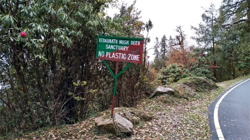
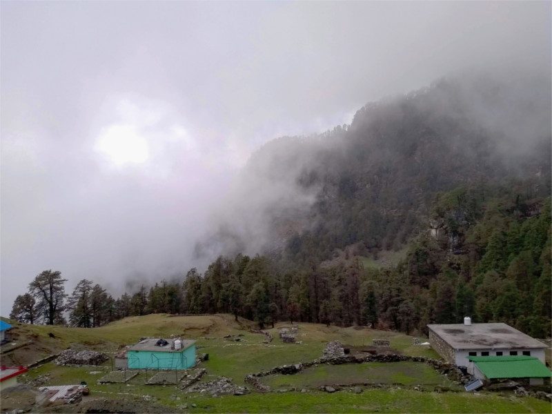
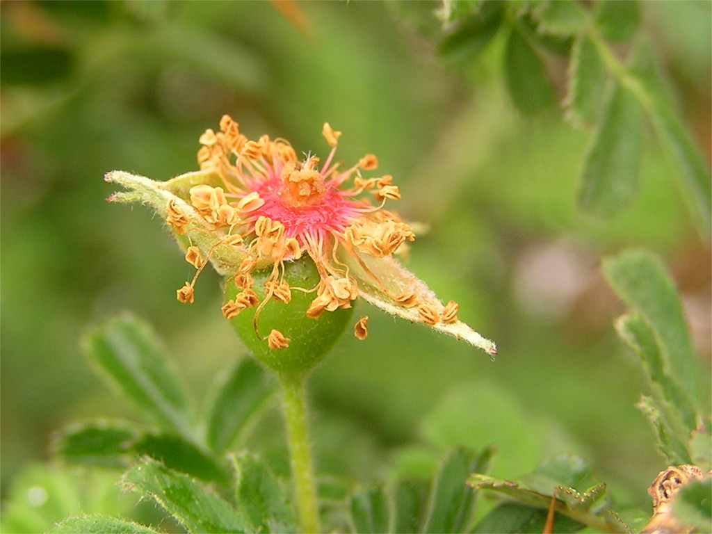
As the stay-at-home spouse, I was quietly envious of The Family when she sent me photos of her journey to the Kedarnath range of the Garhwal Himalayas. I especially loved the featured photo. The last line there seems like wishful thinking; highways are arteries through which plastics circulate in nature.
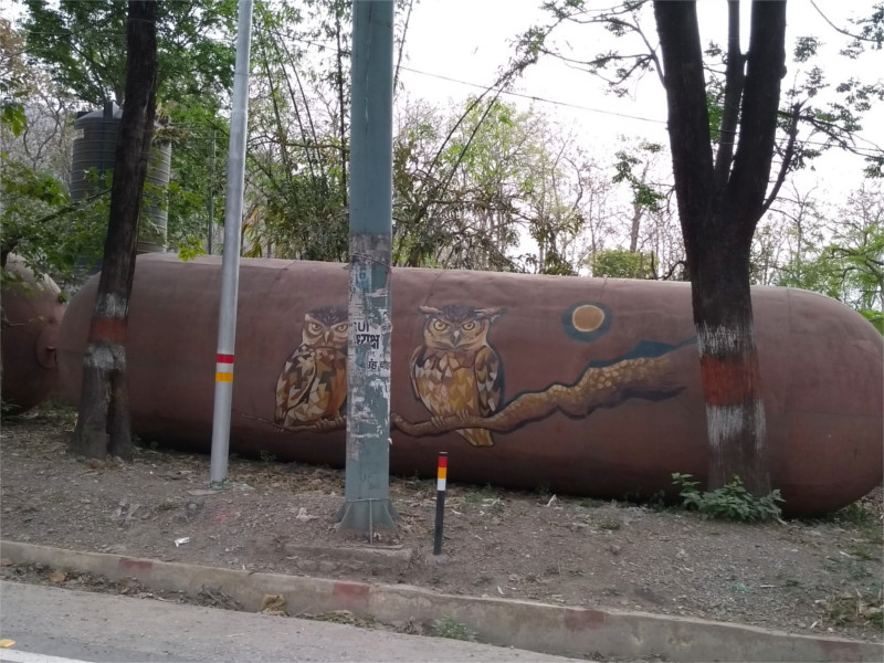
But to start at the very beginning, The Family sent a string of photos of these metal sausages by the road. Why were they there? No one around her knew, but they were nicely painted. There were deer and birds. These spotted owlets were really nice.
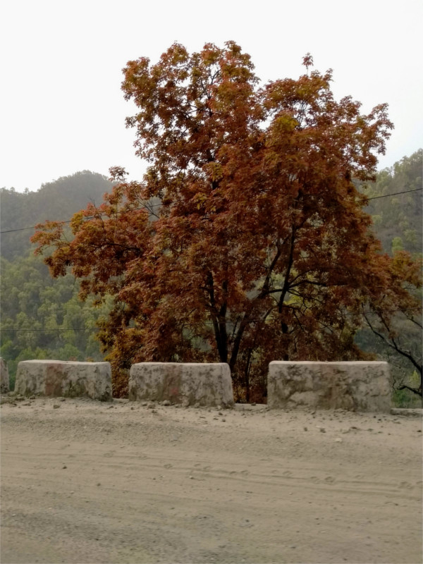
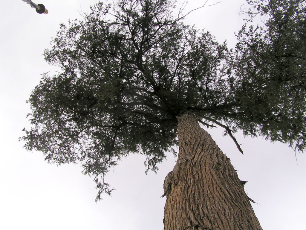
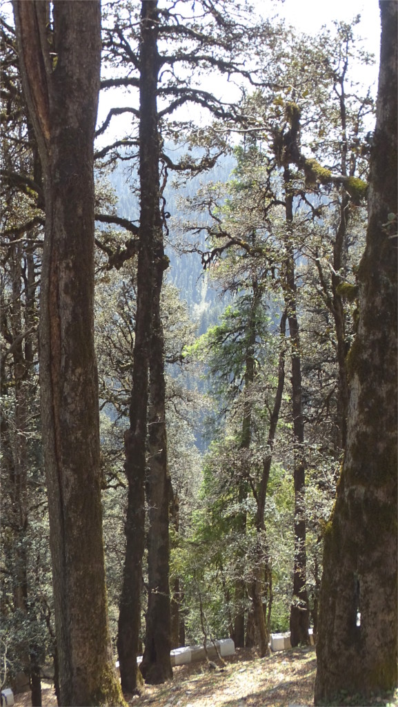
The weather was strange, and the light through the clouds was an odd yellow which made this tree stand out. I think at this time they were still fairly close to Dehra Dun, on their way up to the Alaknanda.
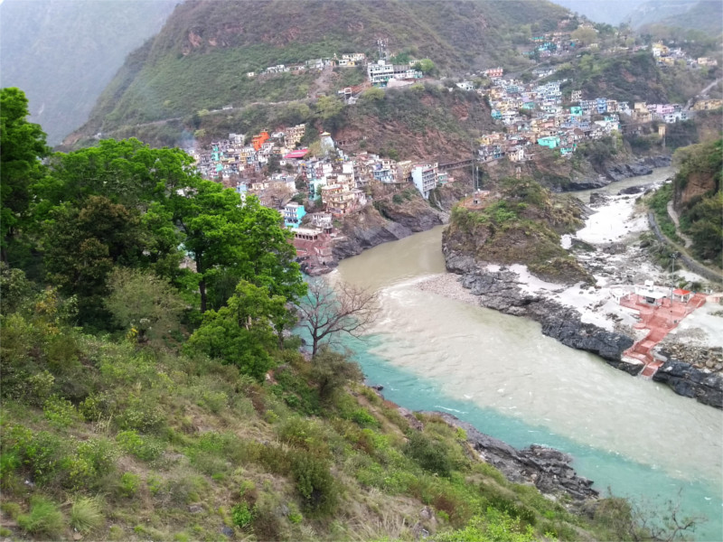
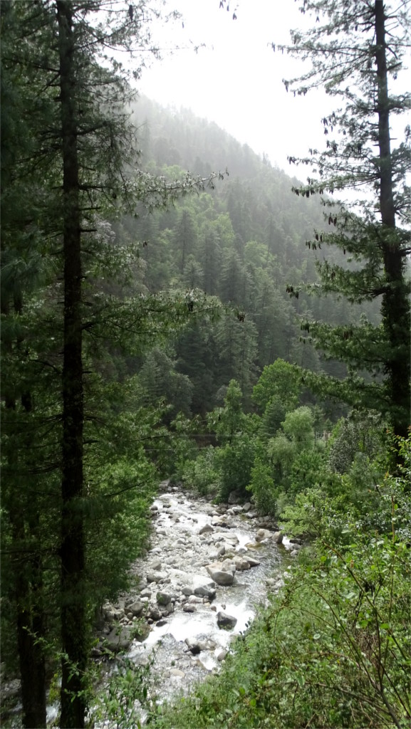
Around midday she must have passed Devprayag. The blue waters of the Bhagirathi and the brown of Alaknanda rivers join at this point to become the Ganga. A quick explanation is that the dam at Tehri upstream on the Bhagirathi allows the silt to settle down, so that by the stream that arrives at the Devprayag is blue. But this otherwise convincing reply is wrong. As an observant blogger pointed out, the colours of the streams change with season.
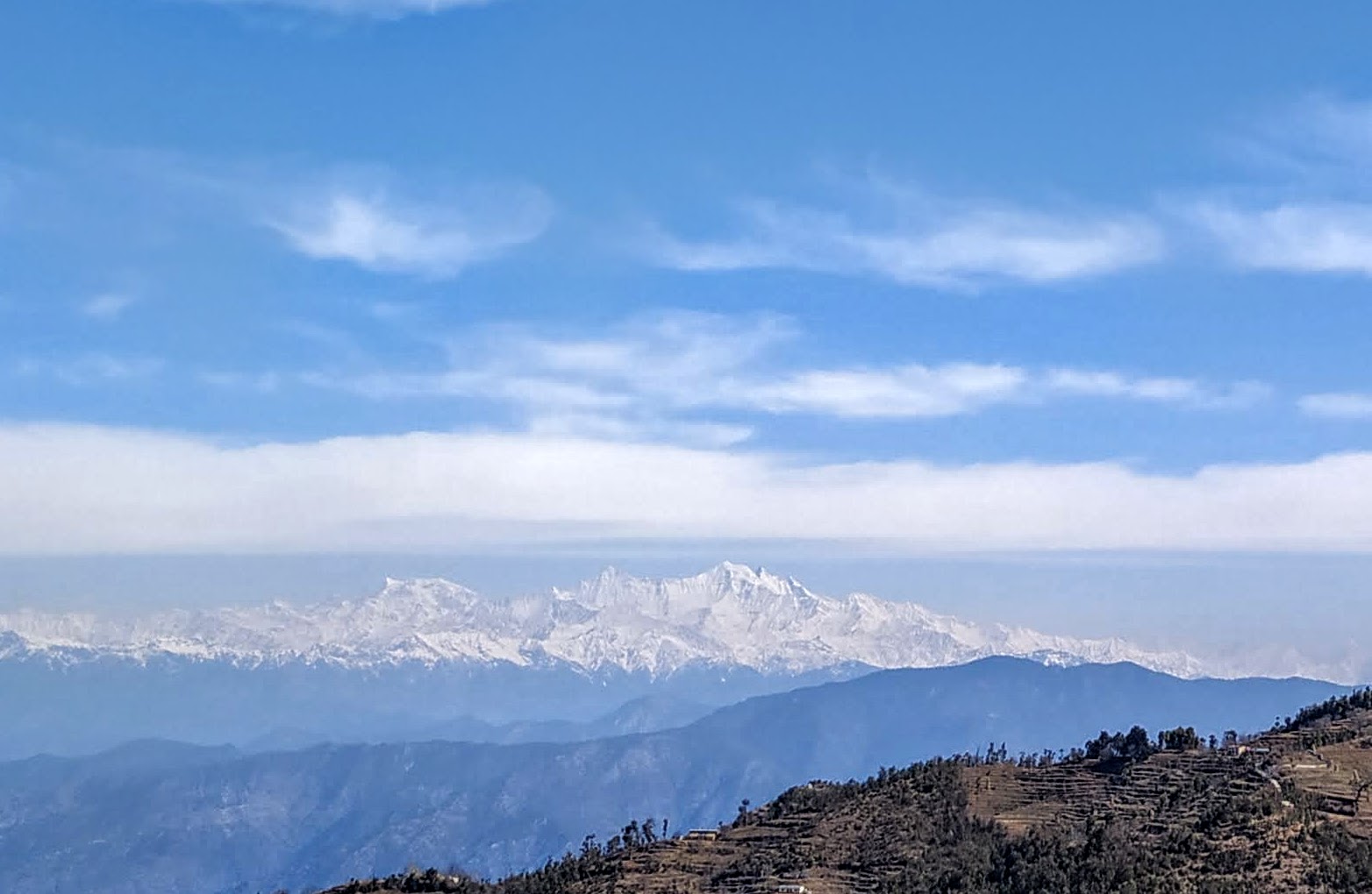
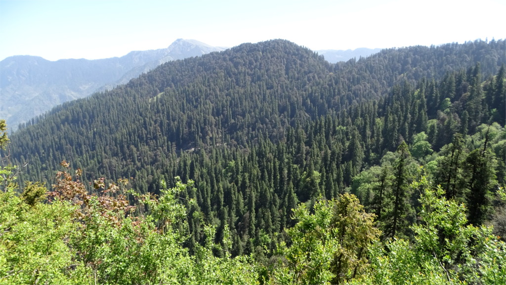
The photos from further up are gorgeous. The Family complained about the cold; it was past mid-April and the temperature on some days went down to nearly freezing. Sitting at home in warm Mumbai I enjoyed the photo of fog rolling down the Himalayas much more than she did. Disappointingly, she never had the views she expected of the Nanda Devi (7.8 Kms high), Trishul and Chaukhamba (both 7.1 Kms high) because of the clouds. This winter has been severe in the Himalayas, due to the same disruption of the polar vortex that gave the USA a record winter. If it weren’t for that, the second half of April would be a wonderful time for these views.
And now, in the middle of April the Rhododendrons were in full bloom, finally. In the last few years we’ve gone too early in the season to see this flowering. I was happy to get a lot of photos of these upper meadows around Chopta, at an altitude of 2.6 Kms above sea level. The Family was very happy with the flowers.
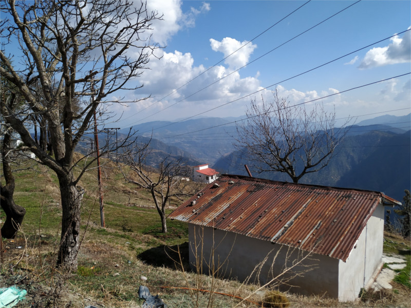
When we reached our hotel with the wonderful view of the mountains from the balcony, it was a little past noon. We sat on the lawns and had a crisp thin-crust pizza and beer so well chilled that even at this height moisture was dewing the bottle as it sat on the table. The air was crisp and cool, as it should be at an altitude of over 2.5 kilometers above sea level. After lunch we could sit in the balcony, look out at the mountains and aestivate. Or we could go for a walk. We chose to walk.
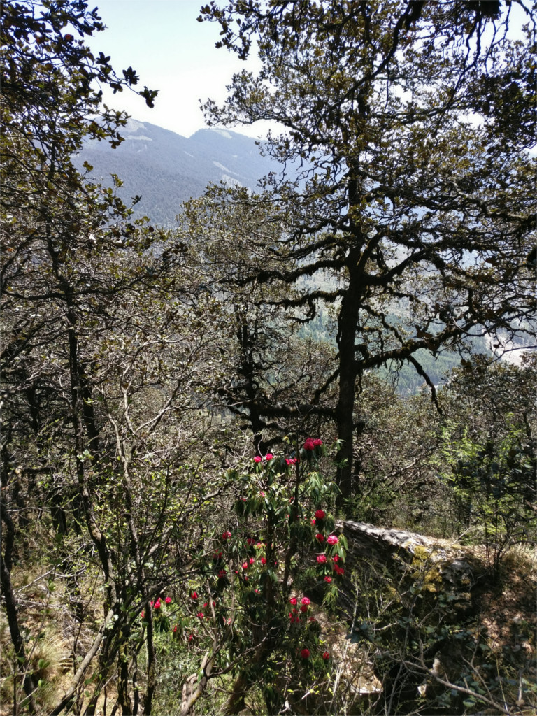
The afternoon’s light was mellow. One side of the road sloped down to fields and a village spread very sparsely over the hillside. It was nearly spring time. The snow had almost completely melted, and only shaded fields and slopes gleamed white in the afternoon. The sloping metal roofs of huts were weighed down by stones. Ruskin Bond in one of his books mentions a corrugated iron roof which was blown away in a storm and decapitated an “early-morning fitness freak”. At the sight of the stones I was reminded of that. But we were safe; this was not early morning.
The road was deserted, but suddenly there was an apparition in front of us. Was it a ghost? No. From the way it swayed and sang it could only be the village drunk. We passed an agricultural research lab where rows of apple trees had grafts on them and were beginning to bloom. A large oak on the side of the road was full of sparrows. When we stopped to watch, we saw a pair of Streaked Laughingthrush (Trochalopteron lineatum) in the undergrowth. They are shy birds, preferring to hop about under cover, and are difficult to photograph. I was not satisfied with the photos which I got.
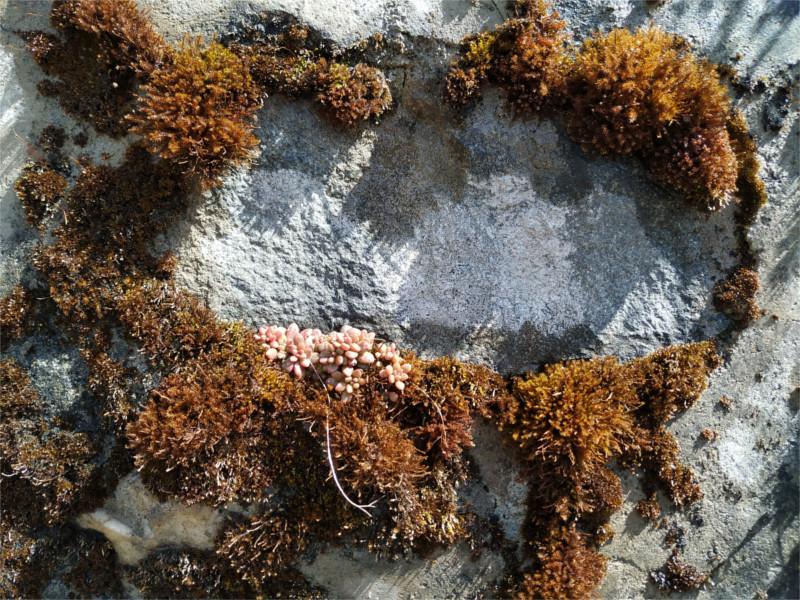
Moss grew on walls here, poking out through the mortar between the stones. I keep thinking that I’ll try to get a field guide to the mosses of India, expect that there is no such book. As a result, I have no idea which moss I’m photographing. One of these was beginning to flower. Although the solstice was a few days away, spring had come to Garhwal’s Sivaliks already.
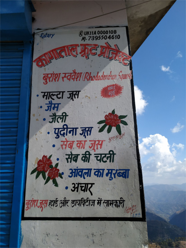
The shops at the turn of the road were all closed for the afternoon’s siesta. I loved their collection of preserves and juices. juice of rhododendron, mint, apple and the new citrus hybrid called the Malta were advertised, along with jams, chutneys and pickles. The British were convinced that rhododendron is poisonous, although locals have been drinking its juice for ages. We reminded ourselves that we would have to come back here later; we’ve always enjoyed drinking this juice when we are in the mountains.
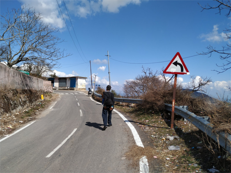
We walked on for a while more, but then clouds started to drift in. The weather prediction was of light rains in the afternoon. We turned back; it would be a twenty minute walk back to the hotel. It would be time for tea when we got back.
There was little time to prepare for our trip to the Himalayas. I worried about whether I should pack Pradip Krishen’s field guide to the trees of Delhi, but then decided against it; after all most of this book dealt with trees of the plains. There are excellent guides to the birds of India, one for butterflies, ancient ones for other animal orders, and certainly nothing for the trees of the Himalayas. One of the few useful resources I came across was an excellent blog post on the trees of Shimla.
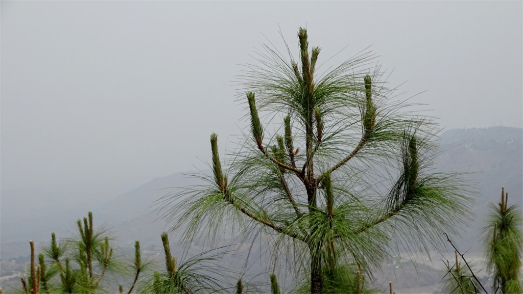
Chir pine (Pinus roxburghii)
White oak (Quercus leucotrichophora) and Rhododendron arboreum
Deodar (Cedrus deodara)
The quick field guide which I made for myself can be useful on future trips. There is such an incredible variety of trees across the Himalayas that anyone could spend a lifetime studying them. The little part which is captured in this small list served me as landmarks to orient myself by.
Name
altitude
characteristics
Deodar (Cedrus deodara) Himalayan cedar
1700-2750 meters across Himalayas
conifer, 40-50 meters tall, 10 meters girth, generally grows on northern slopes search
Rai (Picea smithiana) spruce
2250-2750 meters Western Himalayas
conifer, 40-55 meters tall, 3 meters girth, higher branches are upward pointing, really long needles, generally grows on northern slopes search
Rau (Abies pindrow) silver fir
2500-3700 meters Western Himalayas
40-60 meters tall, 7 meters girth, gray-brown furrowed bark, overall conical shape with level branches, needles have a white streak on the underside, dark purple erect cones, generally grows on northern slopes search
Chir (Pinus roxburghii) Himalayan pine
500-2000 meters across Himalayas
heavy cone, 40-50 meters tall, 6 meters girth, rough bark, needles are arranged in bundles of three, prefers southern slopes search
Kail (Pinus wallachiana) blue pine
1800-4300 meters across Himalayas
long cone, 30-50 meters tall, needles are arranged in bundles of five, bluish in colour, generally grows on northern slopes search
Banj (Quercus leucotrichophora) Himalayan white oak
1500-2400 meters Western and central Himalayas
15-25 meters tall, twisted gnarled trunk, rounded canopy, underside of leaves is white and hairy, acorns edible search
Moru (Quercus floribunda) (also Quercus dilatata) Himalayan green oak
1700-2700 meters Western Himalayas
25-30 meters tall, 6-9 meters girth, straight trunk with dark reddish brown bark, leaves 4-6 cms long and green on both sides search
Kharsu (Quercus semiscarpifolia) Himalayan brown oak
2800-3250 meters Western Himalayas
25-30 meters tall, 4.5 meters girth, straight trunk with domed crown, dark grey bark broken into small plates, 2.5-10 cm long leaves, with brown underside search
Phaliyant (Quercus glauca) ring-cupped oak also Japanese oak
widespread
15-20 meters tall, straight trunk with domed crown, dark brown furrowed bark, leaves purple red when new, powdery blue-green underside when older search
Bras diverse genus rhododendron
1500-3000 meters across Himalayas
shrubs and small trees, glossy leaves, sometimes with a scaly underside, bright flowers search
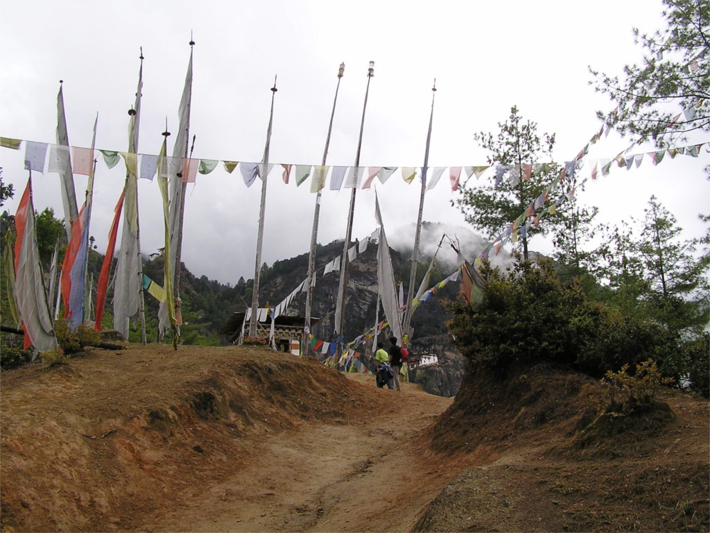
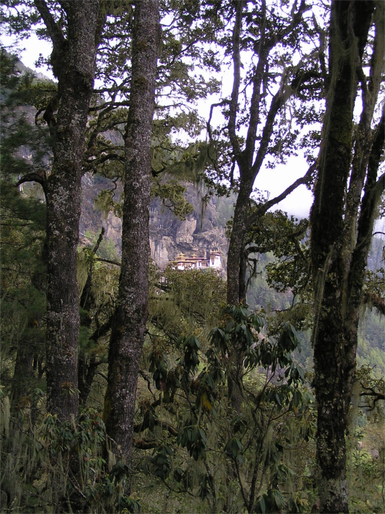
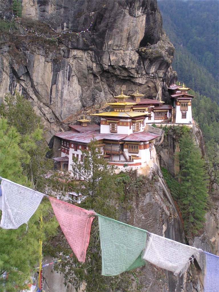
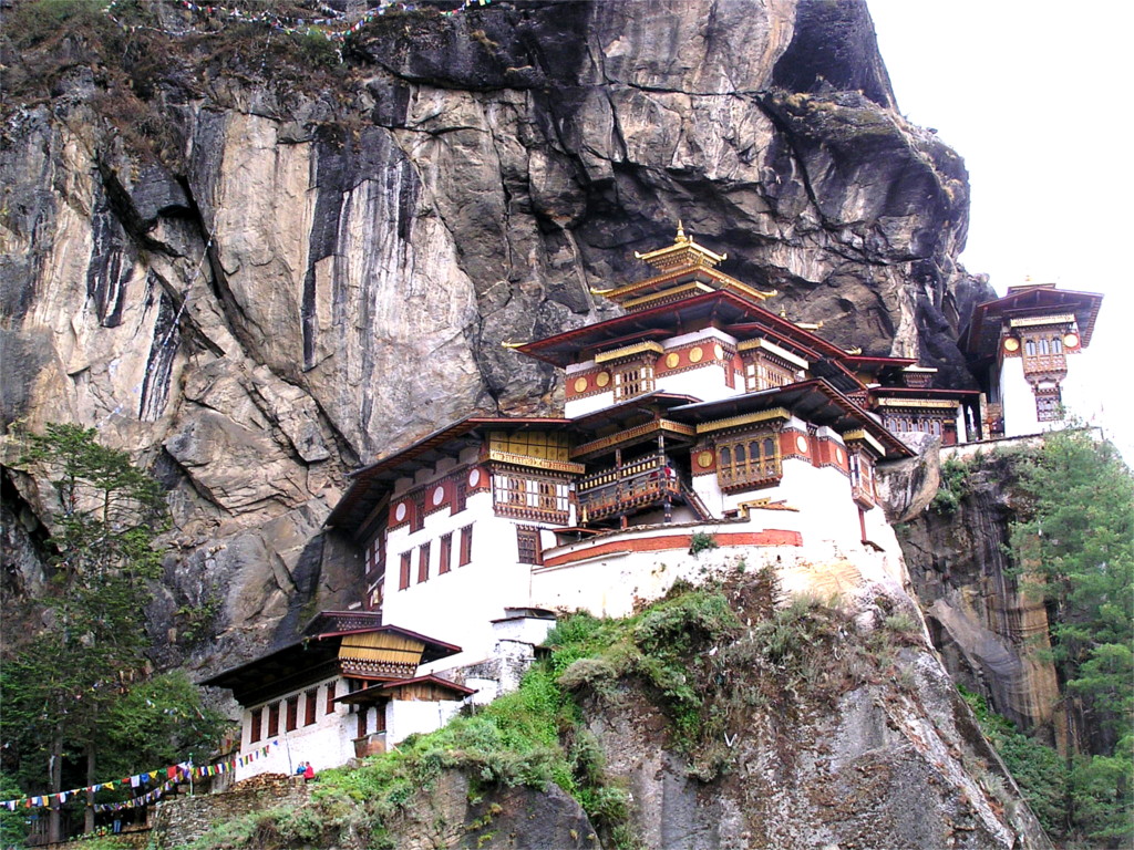
Taktsang monastery, near Paro, is situated at an elevation of 3120 meters. The first view of it is spectacular (see the featured photo). But when I reached the base of the climb and saw the monastery hanging on a cliff a kilometre above me, my heart sank. I had really old and bad shoes, and I was physically out of condition. I told The Family I would not be able to climb.
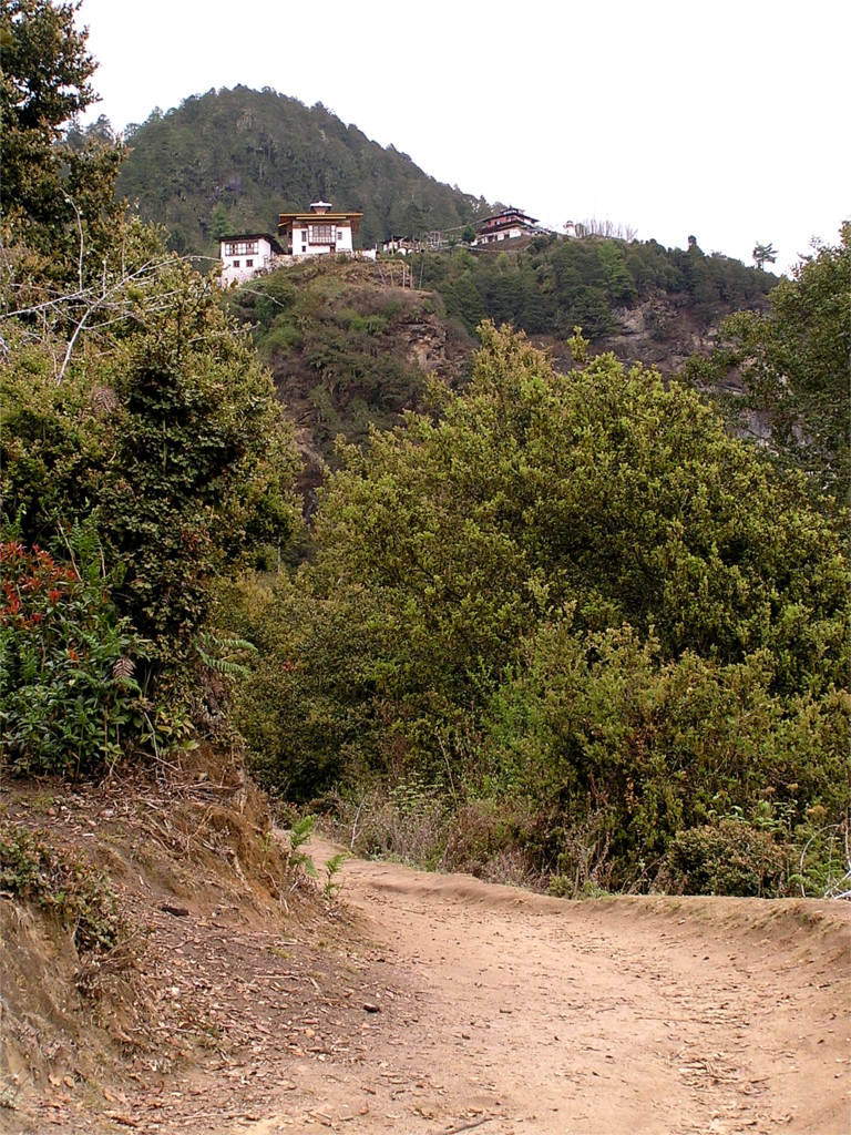
She wanted to do it, and The Sullen Celt assured her that it was an easy walk. I was not convinced, since The Sullen Celt is a trekker and is unable to compensate for other people’s lack of fitness. Someone else said that the group of buildings that we could see part of the way up included a cafeteria with a great view of the monastery. I allowed myself to be persuaded by The Family that I could sit and have a coffee there while the rest of the gang climbed. The first twenty paces were a little bit of steep rock, but then the path became a dirt track, as you can see in this photo. This would become of great consequence on our way down.
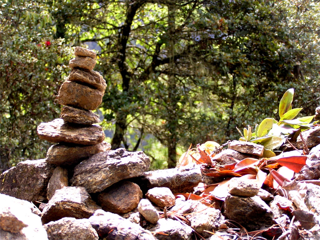
The initial climb was less hard than I’d expected. Previous travellers had dawdled during the climb through the rhododendron forest. We saw several small stacks of carefully balanced stone. It is reassuring when you see that someone sat down at a point where the climb was beginning to get steep and caught her breath doing something slow. I recently read a diatribe against them, and found myself agreeing. However, Bhutan teaches you the art of balance: the whole landscape of the country is a lesson in how to live in nature without overwhelming it.
We left behind the forest bright with red rhododendron flowers and climbed higher. This was the realm of blue pines (Pinus wallichiana). As the road steepened, I had a lovely view of the monastery through the pines. It did not seem to be any closer.
Takstang monastery was built by the fourth king of Bhutan, Tenzin Rabgye, in a site that was already holy. The legend of this place, called Taktsang Phelug (Tiger’s nest), is that the Guru Padmasambhava converted a Tibetan princess to Buddhism. She took the form of a tigress and flew with the Guru to this place. There he meditated, and emerged in eight different forms to subdue demons. The tsechu here has been used many times to consolidate national feelings. The first king, Ngawang Namgyal (also known as Shabdrung Rinpoche), performed the tsechu here in 1644 at the beginning of the war against Tibet, and invoked the story of the Guru as a metaphor for the war. His wish to build a temple here was finally fulfilled when Tenzin Rabgye declared the start of the works in the tsechu of 1692.
Clouds were massing over the mountain, and flowing slowly down its sides as we climbed. The light was now worse, but it made the pine forest into a magical kingdom. Many of the trees were covered thick with orchids. We came to the point where the road to the cafeteria branched off. By now our group of climbers had stretched into a long thin line. If I went off to have coffee I would leave The Family to do the climb alone. Better prepared walkers would have no problem with this, but both of us were terribly out of shape that day, almost exactly a decade ago. So we decided to stick together. At this time I thought that the hard work was done, and it would not be much longer before we reached the monastery. So we went on.
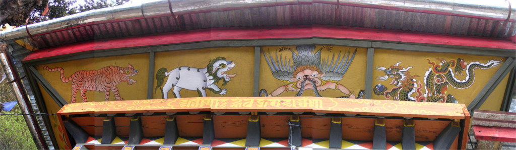
There was a little temple, a Lhakhang, nearby. I paused to take photos of the four sacred animals painted by a local artist. From left to right you can see a tiger, a snow lion, a Yamantaka, and a dragon. This may have been the first time I saw these guardians all together, but I was to come across this combination many times over the next decade. The most beautiful representation I came to see was in the Dubdi Gompa in Sikkim. At this time I didn’t know that the Yamantaka was a representation of the Manjushri Buddha, and the snake he eats is death.
I was completely wrong about the major part of the climb being over. The steepest part came after this. I have no record of this long climb because I had to put my camera into my backpack for a bit when I had to use my hands to steady myself. After that I was too tired to take it out again. I did not notice the soft sounds of wind through the pines and water dropping on rocks, things that The Family still remembers at times. I was completely out of breath when I reached the highest part of the route, all I noticed as I sat down on a rock parapet was that we were surrounded by prayer flags. The Family went over to the other side and realized that we were at a special place, where we could actually look down at the monastery. This was a pleasant view indeed.
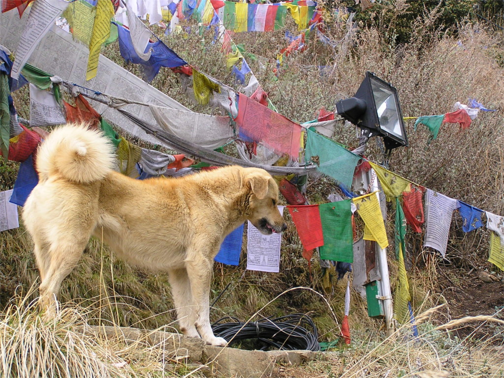
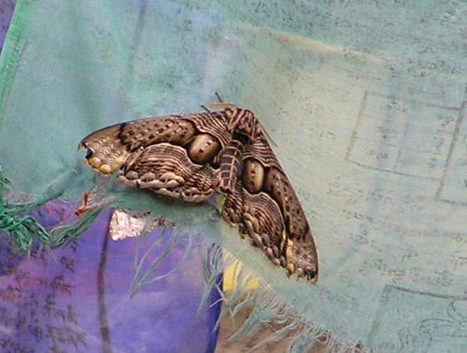
We stopped here for a long while. The road dips down steeply beyond this, and a waterfall cascades between this mountain and the next one. We would cross between the two over a bridge and then walk up the next one into the monastery. It is not a long walk, but I had to prepare myself. This stage has two packs of territorial mountain dogs. They stand on the two mountains and bark at each other. I haven’t seen dogs with such a curly tail before. I paused to look at the flags when I noticed a moth sitting on one. As I took the photo you see here, The Family pointed out that the flags were full of moths of many different kinds. I was just beginning to learn to identify butterflies, but moths remained out of reach: then, as well as now. There are just too many kinds.
We went on down. The sound of the waterfall soon drowned out the barking of the dogs. There were Redstarts flying about near the water, flitting from stone to stone. We saw these birds for the first time in Bhutan, but were to see them many times later. The climb after this took all my breath away. I reached the monastery panting from the climb and sat down on the steps. Climbing those last few steps seemed too hard.
The last photo I have is the one above, taken just a little before the end of the last climb. I walked into the monastery, and must have seen some of it, but nothing remains in my memory. There was a major fire which destroyed Takstang monastery in 1998, ten years before our climb. The fire killed a monk and destroyed many old paintings and statues. What we saw was largely rebuilt with material brought up on the backs of men. What tremendous labour that is! Just a climb with a camera and water had tired me out so much.
It started to rain as we were up in the monastery. Someone suggested that we wait it out, but The Sullen Celt said it was not going to let up soon, and we should start off right now. She was right about the rain, but not about the walk. We made our way slowly back down to the waterfall and up again over rocks made slippery by the rain. Then, as we headed down through the forest the skies opened up and a really heavy rain started. The dirt track through the forest became a river of mud as we made our way down. We slid down parts of it and by the time we reached the bottom the rain had stopped and the sun was out. The warm sun baked hard the mud that we were now crusted in. It was a long time before we could get it off. We would do the climb again if we went there now.
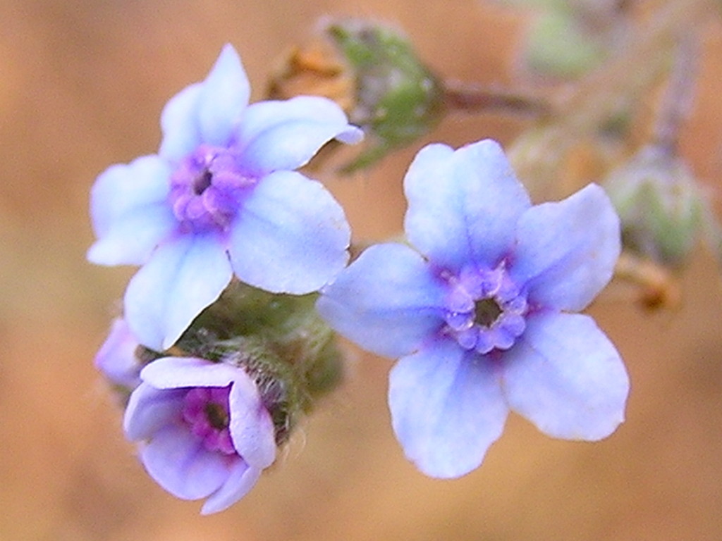
We flew in to Paro on a wet and gloomy morning. This was the most wonderful weather that we could think of. The previous night in Kolkata had been hot and sultry, like Mumbai. A place where spring means something was wonderful. Paro is at an elevation of only 2300 meters, so the local wild flowers are likely to be similar to Europe. I initially mistook the flower in the featured photo for a Forget-me-not. It is not that, but I don’t know what it is.
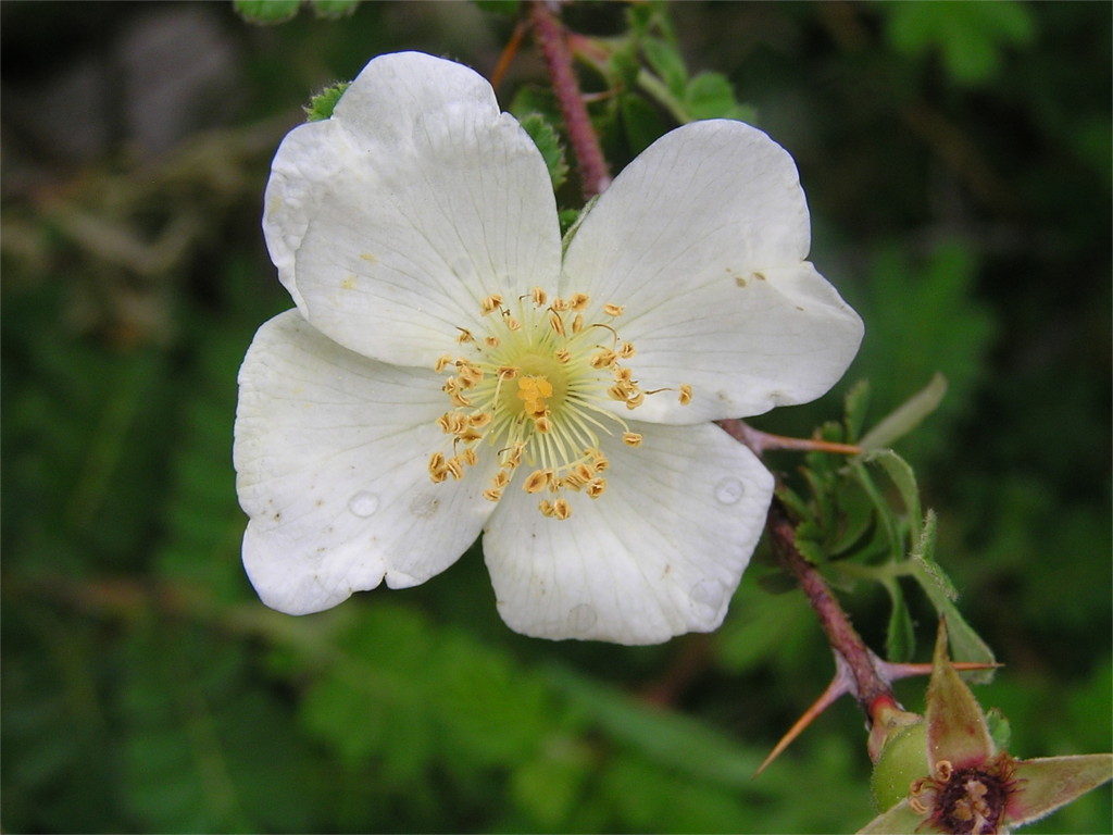
Just outside the airport we began to see flowers growing wild. This small but beautiful white flower was very common. I think this is some kind of a Himalayan wild rose. (I later found that it is the Himalayan musk rose, Rosa moschata.)
When I saw my first Forget-me-not of the trip, I realized that it is hard to mistake it for something else. The problem is that you can mistake something else for it.
I saw this hardy little weed growing out of a crack in a metalled road. It was doing well enough to flower. Looking at the photo now, after almost a decade, I realize that the camera I had then was much better suited to macros than the one I have now.
This flower stumped me. All I remember about this is that it would grow into a small green fruit; the bush was full of them. I don’t know whether it is edible, or what it is called.
This flower is another enigma. Even more so than the previous one, since I do not even remember where in Paro we saw it.
We had to wait in Paro for a day for the rest of our group to meet up with us. We took our car and drove up to Chele La. At a height of 3700 meters above sea level, this is the highest motorable pass in Bhutan. On our trip to Bhutan the previous year, we came to Chele La on the last day of the trip. Now, more or less just off the plane, I realized that I was not yet comfortable at this altitude. No headache, but I had to move slowly.
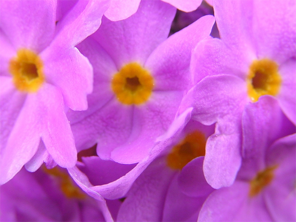
A species of primrose called Primula denticulata grows widely in higher parts of Bhutan and Sikkim. The long stalks of the plant with a globe-like inflorescence could be seen in many of the meadows. It is a beautiful colour when it catches the sun.
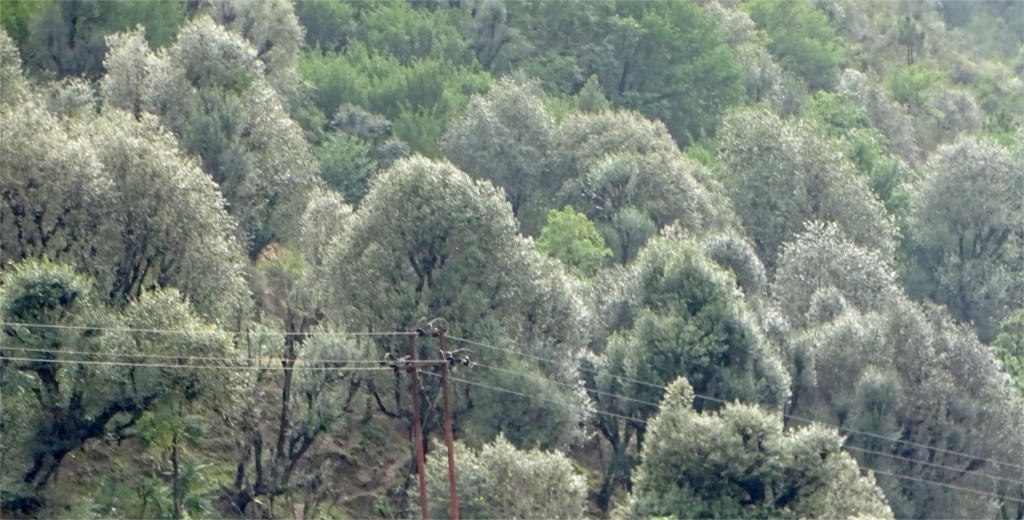
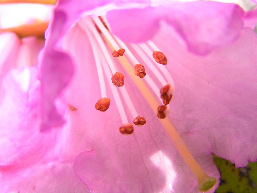
The star of the season at these altitudes is the Rhododendron. You get it in all shades from white to dark red. Here is a close up of a pink rhodo. There were large groves of Rhododendron around the road as soon as we left Paro, and they came up fairly close to the top of the pass. We would see them again and again as we travelled through Bhutan than May.
I was happy, but The Family was very sad. The previous year we had our first view of Khalij pheasants near Chele La. As we drove back down, we saw a pair run across the road and disappear. Now we were both equally happy.
Sikkim is the most accessible part of the belt running across the Himalayas where Rhododendrons grow. We’d seen them wilting when we visited Yumthang a few years ago in early May. Now, in early March we saw them in bloom when we visited the Norbugang throne in Yuksom. We sat on a bench in the garden near the throne and looked at the deodars festooned with prayer flags. Below them were the bushes of Rhododendrons, heavy with flowers. Some had dropped around a little building lower down. It was quiet, pleasantly cool, and serene. I composed a little piece of doggerel and recited it to The Family: “My blood is red as a rhodo, until I become as dead as a dodo”.
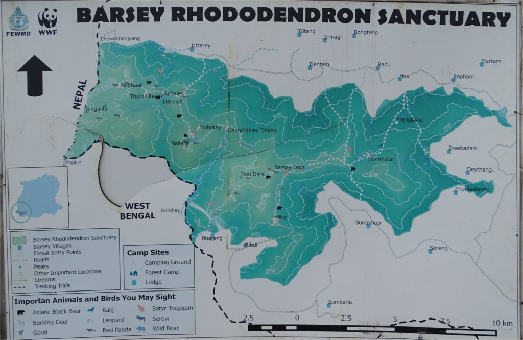
She said, let’s go to the Barsey Rhododendron Sanctuary. I’d read about this before coming. It seems that you can reach it if you take a long walk, some say 8 Kms, from Uttarey in the north or a short walk, about 3 Kms, from Hilley in the south. I’d hesitated to do this because we didn’t know the terrain and couldn’t predict how long it would take us to cover 16 Kms. Now we decided to travel to Hilley and take the shorter walk. It turned out that Hilley was around 80 Kms from Pelling, over roads that were not in very good shape. The drive took us 4 hours. We passed through beautiful roads, the greenery blooming red with flowers of the rhododendron. Hem Kumar told us that his friends did not believe he would see the flowers today.
My faith in Hem Kumar’s unfailing fallibility grew as we climbed, and the red flowers became rarer. It was probably too early for high-altitude flowers inside the Barsey sanctuary. It turned out (map above) that Hilley was already inside the sanctuary, and the 3 Km walk was to a nearby ridge from which Kanchenjunga would be visible. The bright sunshine of the morning was hidden behind fog and clouds as we started on the path. We saw some leaf warblers and tree-pies in the dense jungle. Little streams flowed down the rocks next to the path. Primulas bloomed everywhere. Rhododendron buds were visible on every tree. They would flower in a week or two. It was a lovely walk, until it started to rain. We turned back after about twenty minutes of walking, perhaps somewhat over a kilometer.
The Family reminded me of the Rhododendron juice we drank on our previous visit to Sikkim. Hem Kumar didn’t know of it. A journalist, Sumana Roy, has a peculiar recipe for rhododendron chutney: “A handful of flowers, about five or six fresh red rhododendrons, crushed into a paste with a clove of garlic, a tomato, and its sweet-sour balance refined by the addition of pomegranate juice or molasses and mango powder, depending on individual preference.” On the other hand, there are warnings, persisting to modern times that all parts of tree are poisonous, even the honey. Perhaps these are like mushrooms, some species are poisonous and others are edible.
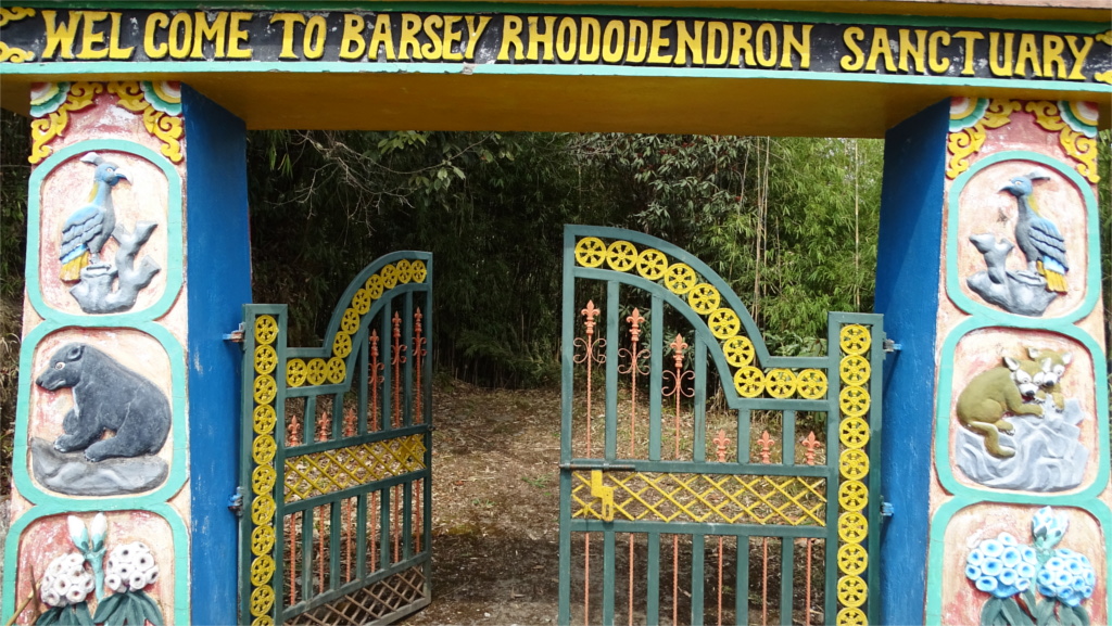
As we exited the gate of the sanctuary, we saw some birds foraging nearby. One fluttered from a little hut to a bush. My first impression was that we it was a coucal, but The Family realized that it was something else. We stood still, and the bird flew next to us. This was our first view of the chestnut crowned laughing thrush. My camera was packed away in my backpack. We stood still and watched. Eventually, The Family reached into my backpack and handed me my camera. As I sighted, the bird flew off into a dark undergrowth. We spent the next day at a lower elevation and saw many kinds of Rhododendron. The ASI has planted many varieties in the garden it maintains around the ruins of the Rabdentse palace. This photo shows something which is perhaps visible only in this part of the world: Rhododendron and bananas next to each other.
We have bracketed the flowering season of the Rhododendron: after early March and before May. We need to visit Sikkim in early April once.